Sign in
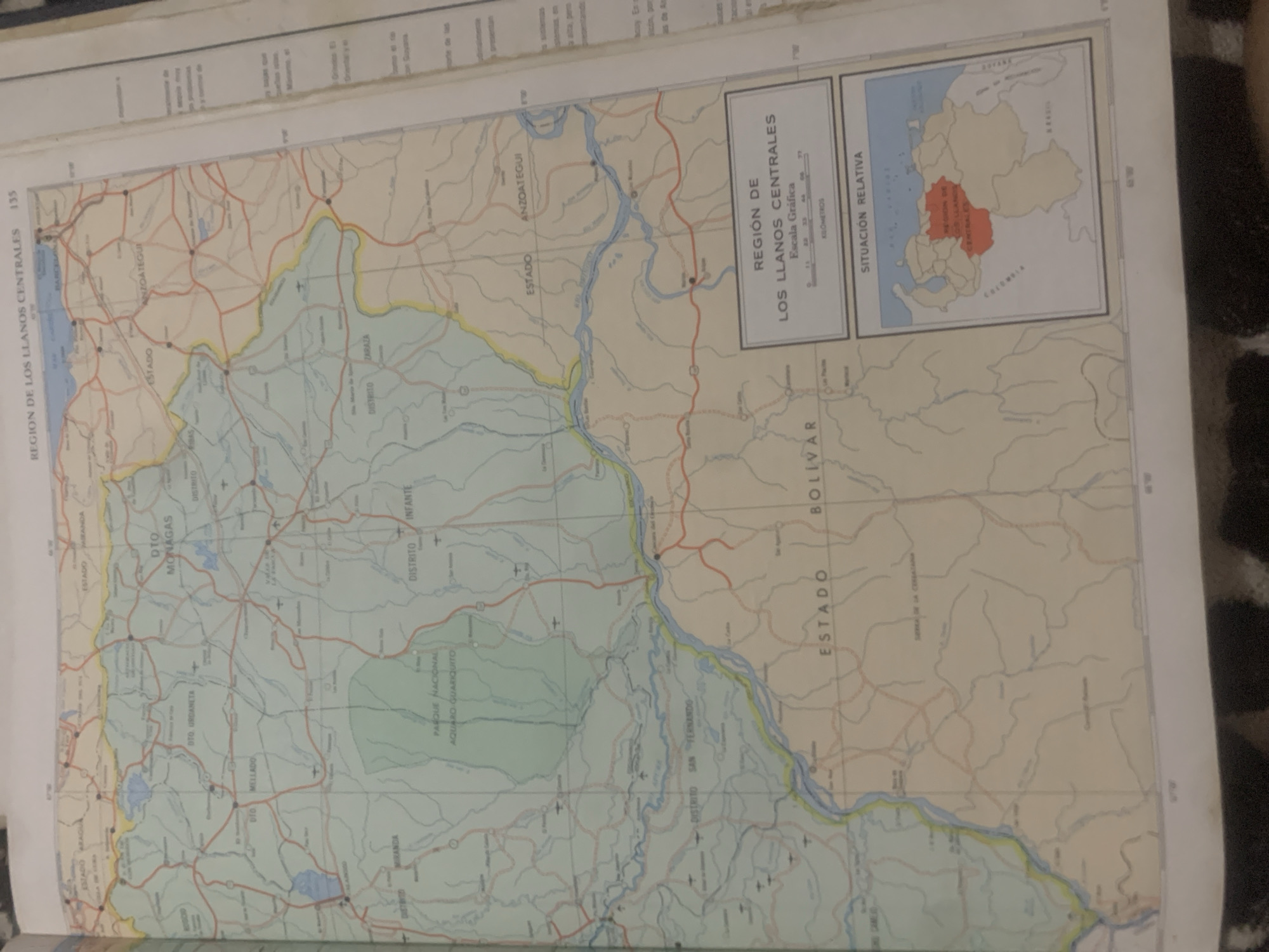
This is a photograph of a map depicting the "REGION DE LOS LLANOS CENTRALES" in Venezuela. The map is a part of a larger publication, indicated by the page number "135" on the top left. The map itself shows various geographical features, including rivers, lakes, roads, and political boundaries. Several states and districts are labeled, such as ESTADO MIRANDA, ESTADO ANZOÁTEGUI, ESTADO BOLÍVAR, DTO MONAGAS, DTO URDANETA, and DTO INFANTE. A significant portion of the map is colored light green, indicating "PARQUE NACIONAL AQUADRO GUARIQUITO."

In the upper right corner, there is a smaller inset map labeled "SITUACIÓN RELATIVA," showing Venezuela within a larger South American context, with the central plains region highlighted in red. This inset map also provides some international context, mentioning "Guyana" and "Colombia."

Visible text includes titles of regions, states, and districts, as well as a scale bar in kilometers and the title "REGIÓN DE LOS LLANOS CENTRALES." The map appears to be detailed and informative, likely intended for geographical or administrative reference. The overall scene is static, focusing on the printed content of the map rather than any action or people. The lighting suggests an indoor setting, possibly a library or a personal study, where the book containing the map is being examined. The photograph is taken at an angle, with some of the surrounding book pages and binding visible.
bombolico

Jun 25, 2026, 2:45 PM

La Tagua, Venezuela

BLOCKED

Stake attention in this memory

nostalgic
analytical
curious
serious
contemplative

This is a photograph of a map depicting the "REGION DE LOS LLANOS CENTRALES" in Venezuela. The map is a part of a larger publication, indicated by the page number "135" on the top left. The map itself shows various geographical features, including rivers, lakes, roads, and political boundaries. Several states and districts are labeled, such as ESTADO MIRANDA, ESTADO ANZOÁTEGUI, ESTADO BOLÍVAR, DTO MONAGAS, DTO URDANETA, and DTO INFANTE. A significant portion of the map is colored light green, indicating "PARQUE NACIONAL AQUADRO GUARIQUITO." In the upper right corner, there is a smaller inset map labeled "SITUACIÓN RELATIVA," showing Venezuela within a larger South American context, with the central plains region highlighted in red. This inset map also provides some international context, mentioning "Guyana" and "Colombia." Visible text includes titles of regions, states, and districts, as well as a scale bar in kilometers and the title "REGIÓN DE LOS LLANOS CENTRALES." The map appears to be detailed and informative, likely intended for geographical or administrative reference. The overall scene is static, focusing on the printed content of the map rather than any action or people. The lighting suggests an indoor setting, possibly a library or a personal study, where the book containing the map is being examined. The photograph is taken at an angle, with some of the surrounding book pages and binding visible.

Symbol

290C4

Volume

0

Creator

+$0.09

Revenue

+$0.00

TVL

$0.00

1D
1W
1M
All
transactions
revenues
stakers
Earliest
Latest
Highest stake

1

Ramón

Staked 10d ago
Redeemed 6d ago

$7.35 USD

+$0.04 USD

Fee: $0.02 (0.25%)

+0.5%

2

Rev Bot 🤖💰

Injected revenue 10d ago

Revenue bonus for the last stake.

+$0.15 USD

More from this user

More from La Tagua

bombolico

Jun 25, 2026, 2:45 PM

La Tagua, Venezuela

Licensed under Creative Commons Attribution 4.0 International License. You are free to share and adapt this content with proper attribution.





