
Sign in
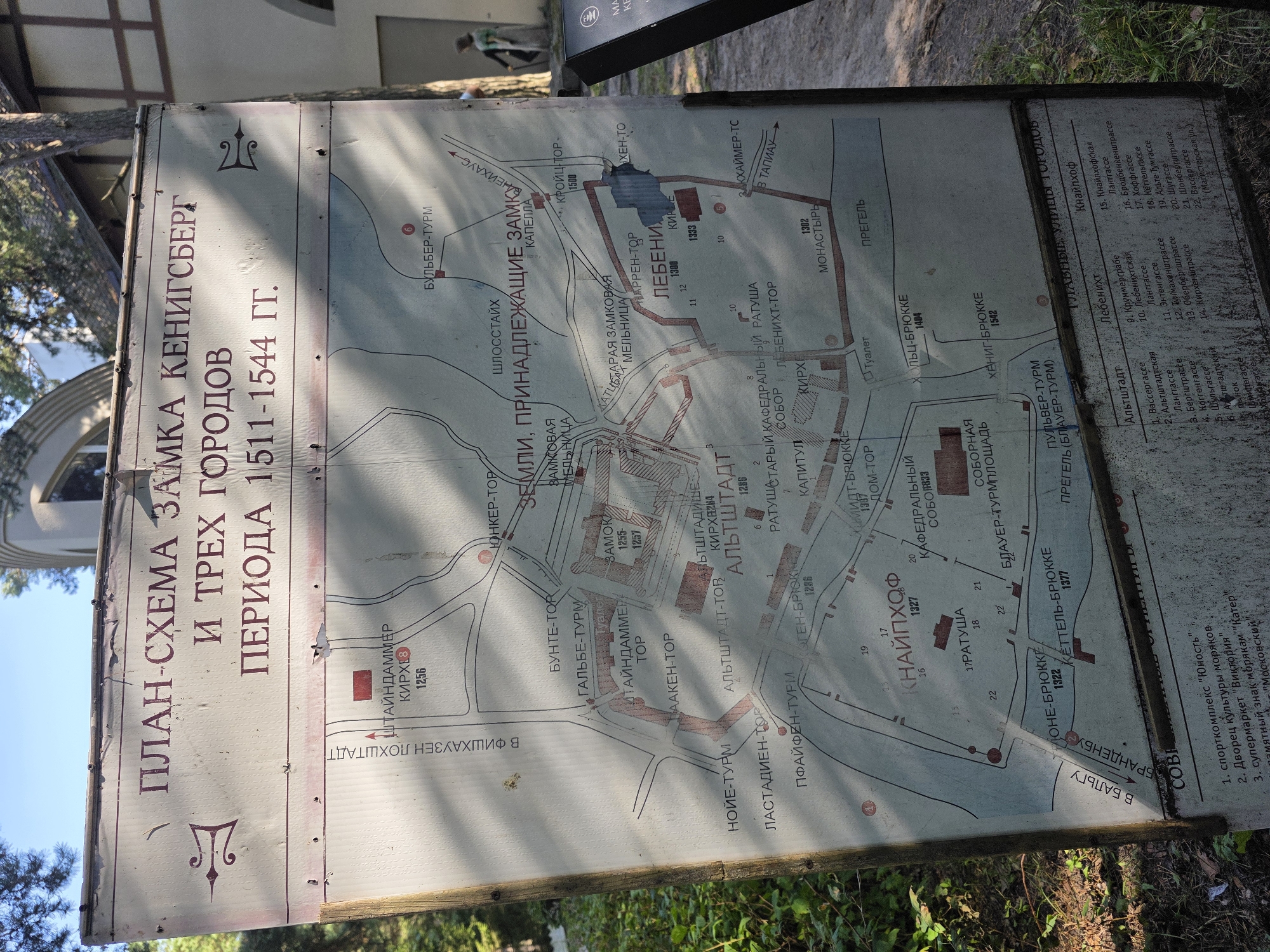
The image shows a weathered, outdoor informational map of Königsberg (now Kaliningrad) with a focus on its castles and city districts during the period of 1511-1544. The map is displayed on a white board, leaning against a building that appears to be part of an exhibition or historical site. The building behind the map has light-colored walls and arched windows, with trees and foliage visible in the background and around the base of the map stand. The map itself is detailed, with various structures and areas labeled in Russian. Below the map, there is a legend with numbered entries corresponding to locations on the map, categorized by districts such as "Altstadt," "Lébeniхt," and "Knaiffhof." The map appears to be a reproduction, possibly for tourists, and the board shows signs of age and exposure to the elements. The environment suggests a park-like or historical outdoor setting, consistent with tourist attractions. The lighting indicates it is daytime, with shadows cast across the map. There are no visible people interacting with the map or in the immediate foreground, though two figures can be seen in the background on the right, walking away from the camera. The overall scene is that of an outdoor informational display in what is likely a tourist area in Svetlogorsk, Russia, given the common display of historical maps of the Kaliningrad region in such locations.
KaterinaYrievna

Aug 21, 2026, 1:47 PM

Svetlogorsk, Russia

Moment

Stake attention in this memory

historical
informative
educational
intricate
navigational

The image shows a weathered, outdoor informational map of Königsberg (now Kaliningrad) with a focus on its castles and city districts during the period of 1511-1544. The map is displayed on a white board, leaning against a building that appears to be part of an exhibition or historical site. The building behind the map has light-colored walls and arched windows, with trees and foliage visible in the background and around the base of the map stand. The map itself is detailed, with various structures and areas labeled in Russian. Below the map, there is a legend with numbered entries corresponding to locations on the map, categorized by districts such as "Altstadt," "Lébeniхt," and "Knaiffhof." The map appears to be a reproduction, possibly for tourists, and the board shows signs of age and exposure to the elements. The environment suggests a park-like or historical outdoor setting, consistent with tourist attractions. The lighting indicates it is daytime, with shadows cast across the map. There are no visible people interacting with the map or in the immediate foreground, though two figures can be seen in the background on the right, walking away from the camera. The overall scene is that of an outdoor informational display in what is likely a tourist area in Svetlogorsk, Russia, given the common display of historical maps of the Kaliningrad region in such locations.

Loading AttnAds…

transactions
revenues
stakers
Earliest
Latest
Highest stake

No transactions found

More from this user

More from Svetlogorsk

KaterinaYrievna

Aug 21, 2026, 1:47 PM

Svetlogorsk, Russia

Licensed under Creative Commons Attribution 4.0 International License. You are free to share and adapt this content with proper attribution.