
Stake attention in this memory
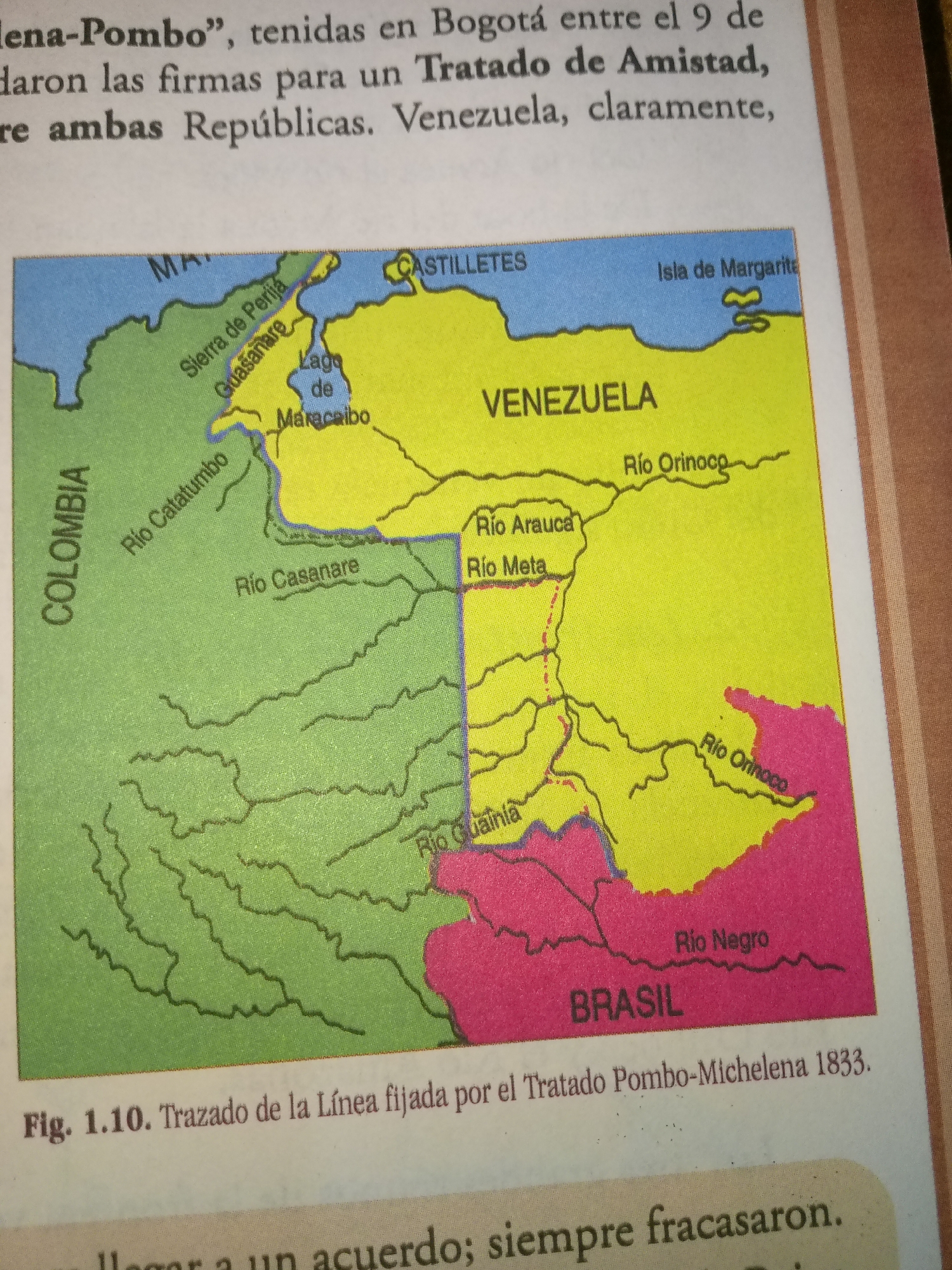
The image is a scanned photograph of a map showing parts of Colombia, Venezuela, and Brazil. The map highlights national borders, rivers, lakes, mountains, and cities. Text above the map describes a historical treaty. The question asks to include the city of Guayacán, Venezuela. However, Guayacán is not visible on this map. The map shows cities like Maracaibo in Venezuela. The map is labeled "Fig. 1.10. Trazado de la Línea fijada por el Tratado Pombo-Michelena 1833." This translates to "Fig. 1.10. Layout of the Line established by the Pombo-Michelena Treaty 1833." The map depicts the border between Colombia (green) and Venezuela (yellow), with parts of Brazil (pink) shown to the south. Prominent geographical features include the Sierra de Perijá, Lago de Maracaibo, Río Catatumbo, Río Casanare, Río Arauca, Río Meta, Río Guainía, and Río Orinoco. The Isla de Margarita is also shown off the coast of Venezuela. The text above the map mentions "Pombo", "Bogotá", "Tratado de Amistad", and "Repúblicas".
Loading AttnAds…
No transactions found