
Stake attention in this memory
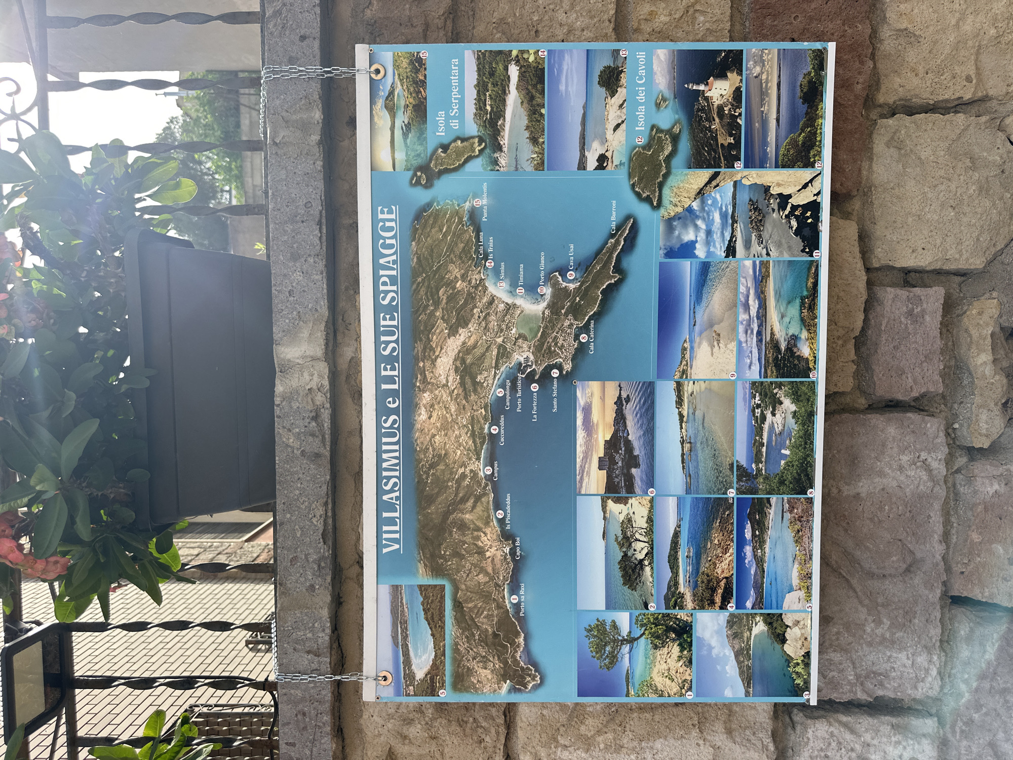
The image shows a map of Villasimius and its beaches, displayed on a stone wall. The map is bordered by smaller photographs of various beaches and islands, each numbered for reference. The title of the map is "VILLASIMIUS e LE SUE SPIAGGE." The map features coastal areas, roads, and labels for different locations such as "Porto sa Ruxi," "Cabo Boi," "Is Piscadeddus," "Campus," "Cucurreddus," "Campulongu," "Porto Turistico," "La Fortezza," "Santo Stefano," "Cala Caterina," "Cava Usai," "Cala Burroni," "Timiama," "Cala Luna," "Is Traias," and "Punta Molentis." The smaller images depict picturesque coastal scenes, including clear blue water, sandy beaches, rocky outcrops, and vegetation. On the right side of the map, two islands are highlighted: "Isola di Serpentara" and "Isola dei Cavoli," with an image of a lighthouse on the latter. The overall scene suggests a tourist information display in the town of Villasimius, Italy, likely near a coastal area. The background includes a stone wall, a metal fence, and a potted plant with flowers.
Loading AttnAds…
No transactions found