Sign in
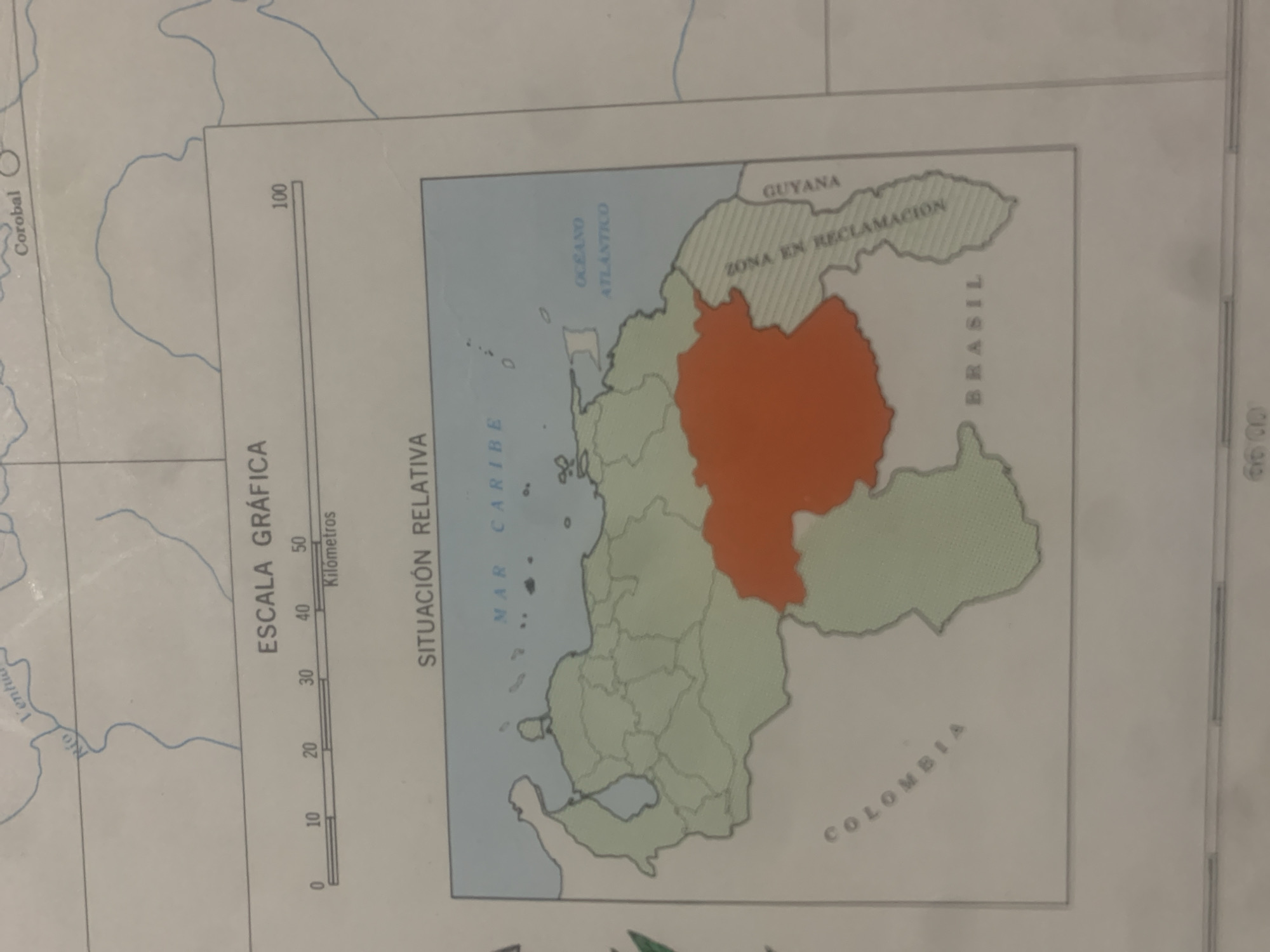
This is an image of a map of Venezuela. The map highlights the relative situation of Venezuela and its surrounding areas, including parts of Colombia, Brazil, Guyana, and the Caribbean Sea. A specific region within Venezuela, colored orange, is labeled as "ZONA EN RECLAMACION," suggesting a disputed or claimed territory.

The map includes an "ESCALA GRÁFICA" (graphic scale) in kilometers, with markings from 0 to 100. Another label indicates "SITUACIÓN RELATIVA" (relative situation). Text on the map also includes names of bodies of water like "MAR CARIBE" (Caribbean Sea) and "OCEANO ATLANTICO" (Atlantic Ocean), and bordering countries like "GUYANA" and "BRASIL." A portion of Colombia is also visible and labeled "COLOMBIA."

There are some additional, less distinct labels, including "Corobal" and "Ventu" possibly referring to geographic locations or features. The image appears to be a cropped or zoomed-in view, as indicated by the presence of what might be a portion of another map or document on the right side, with faint markings "00.99".

The overall scene is a cartographic representation, with no people, specific time of day, or weather conditions evident. The focus is purely on geographical and political boundaries.
bombolico

Jun 25, 2026, 2:38 PM

La Tagua, Venezuela

Short Term

Stake attention in this memory

political
analytical
serious
tense
formal

This is an image of a map of Venezuela. The map highlights the relative situation of Venezuela and its surrounding areas, including parts of Colombia, Brazil, Guyana, and the Caribbean Sea. A specific region within Venezuela, colored orange, is labeled as "ZONA EN RECLAMACION," suggesting a disputed or claimed territory. The map includes an "ESCALA GRÁFICA" (graphic scale) in kilometers, with markings from 0 to 100. Another label indicates "SITUACIÓN RELATIVA" (relative situation). Text on the map also includes names of bodies of water like "MAR CARIBE" (Caribbean Sea) and "OCEANO ATLANTICO" (Atlantic Ocean), and bordering countries like "GUYANA" and "BRASIL." A portion of Colombia is also visible and labeled "COLOMBIA." There are some additional, less distinct labels, including "Corobal" and "Ventu" possibly referring to geographic locations or features. The image appears to be a cropped or zoomed-in view, as indicated by the presence of what might be a portion of another map or document on the right side, with faint markings "00.99". The overall scene is a cartographic representation, with no people, specific time of day, or weather conditions evident. The focus is purely on geographical and political boundaries.

Symbol

2AB0F

Volume

11,550

Creator

+$0.08

Revenue

+$0.11

TVL

$6.81

1D
1W
1M
All

Loading AttnAds…

transactions
revenues
stakers
Earliest
Latest
Highest stake

1

Ramón

Staked 11d ago

$6.77 USD

+$0.04 USD

+0.6%

2

Rev Bot 🤖💰

Injected revenue 11d ago

Revenue bonus for the last stake.

+$0.12 USD

More from this user

More from La Tagua

bombolico

Jun 25, 2026, 2:38 PM

La Tagua, Venezuela

Licensed under Creative Commons Attribution 4.0 International License. You are free to share and adapt this content with proper attribution.





