Stake attention in this memory
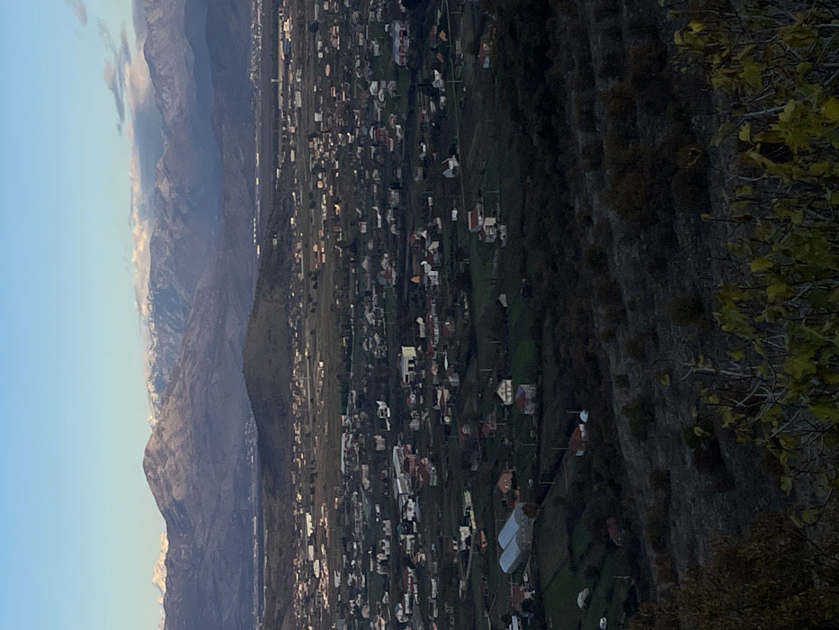
An elevated panoramic view captures a sprawling urban landscape of Podgorica, Montenegro, extending into mountainous terrain under a clear sky. In the immediate foreground, dark, out-of-focus foliage with scattered yellowish-green leaves is visible, obscuring the ground directly below the viewer's position. The midground reveals a vast, low-density residential area comprising numerous detached houses with varying roof colors (predominantly red, white, and grey). These structures are interspersed with patches of green agricultural land and darker forested areas. On the left side of this residential zone, several large, light-colored structures, possibly greenhouses or industrial buildings, are identifiable. A prominent, dark green, conical hill, appearing unpopulated, rises distinctly within the urban sprawl, slightly left of the image center. Beyond this immediate urban expansion, further developed areas and structures are visible, receding into the distance. The background is dominated by a long range of rugged mountains, displaying shades of grey and purple. Numerous peaks are distinctly snow-capped under a clear, bright blue sky that transitions to a lighter hue closer to the horizon. Sparse white clouds are visible above some of the highest mountain crests. No individuals, vehicles, or specific human activities are discernable within the frame. The lighting suggests daytime, possibly late afternoon, with clear atmospheric conditions. The scene is observed from an elevated position, likely from a hillside to the south or southwest of Podgorica, looking northeast towards the Dinaric Alps, with the distinctive conical hill in the midground being identifiable as Malo Brdo.
No transactions found