Sign in
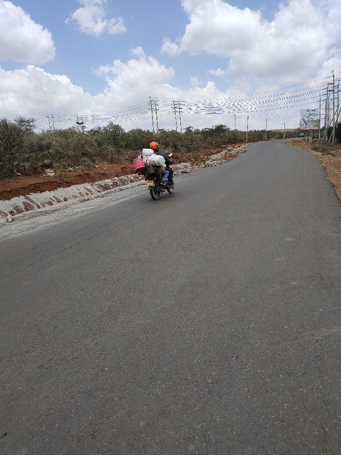
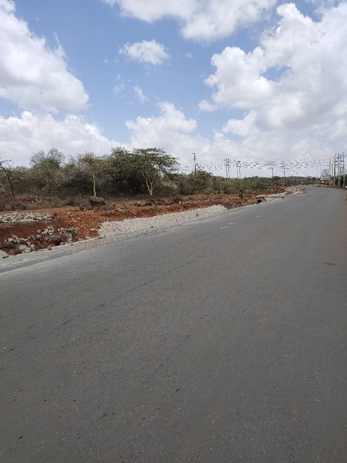
The image captures an outdoor scene featuring an asphalt road, natural vegetation, and utility infrastructure under a bright, cloudy sky.

In the foreground, a smooth, dark grey asphalt road occupies the lower two-thirds of the frame, extending from the bottom left corner and curving gently towards the right in the distance. The road appears to be in good condition, possibly recently paved or well-maintained.

To the left of the road, there's an embankment or shoulder area. This section consists of reddish-brown earth mixed with rocks, suggesting exposed soil. Along the immediate edge of the road, there's a visible construction or reinforcement effort, characterized by a line of greyish-white stones or concrete blocks, possibly forming a drainage channel or a stabilized road edge. Beyond this, further to the left, is dense, dry-looking scrubland with numerous trees and bushes. Some of these trees have light-colored, slender trunks, and their foliage is generally green, indicating a savanna or semi-arid environment.

In the mid-ground and extending into the distance on the right side of the road, a series of wooden utility poles with power lines can be seen. These poles stretch far into the background, indicating significant infrastructure. The power lines create a noticeable visual pattern against the sky and distant landscape. Further down the road on the right, there appears to be a small commercial or informational sign, but the text is too blurry to be deciphered clearly, though faint white lettering like "P**L**E" might be discernible on a darker background.

The background is dominated by a bright blue sky filled with scattered, fluffy white cumulus clouds. The lighting suggests it is daytime, likely late morning or early afternoon, given the bright illumination. No specific human activity or vehicles are visible in the frame, implying a relatively quiet or open area, possibly undergoing development or expansion, given the road and utility infrastructure.
FM-kk0us2

Feb 8, 2026, 9:26 AM

Ewuaso Oonkidong'i ward, Kenya

Stake attention in this memory

road
landscape
sky
trees
utility poles

The image captures an outdoor scene featuring an asphalt road, natural vegetation, and utility infrastructure under a bright, cloudy sky. In the foreground, a smooth, dark grey asphalt road occupies the lower two-thirds of the frame, extending from the bottom left corner and curving gently towards the right in the distance. The road appears to be in good condition, possibly recently paved or well-maintained. To the left of the road, there's an embankment or shoulder area. This section consists of reddish-brown earth mixed with rocks, suggesting exposed soil. Along the immediate edge of the road, there's a visible construction or reinforcement effort, characterized by a line of greyish-white stones or concrete blocks, possibly forming a drainage channel or a stabilized road edge. Beyond this, further to the left, is dense, dry-looking scrubland with numerous trees and bushes. Some of these trees have light-colored, slender trunks, and their foliage is generally green, indicating a savanna or semi-arid environment. In the mid-ground and extending into the distance on the right side of the road, a series of wooden utility poles with power lines can be seen. These poles stretch far into the background, indicating significant infrastructure. The power lines create a noticeable visual pattern against the sky and distant landscape. Further down the road on the right, there appears to be a small commercial or informational sign, but the text is too blurry to be deciphered clearly, though faint white lettering like "P**L**E" might be discernible on a darker background. The background is dominated by a bright blue sky filled with scattered, fluffy white cumulus clouds. The lighting suggests it is daytime, likely late morning or early afternoon, given the bright illumination. No specific human activity or vehicles are visible in the frame, implying a relatively quiet or open area, possibly undergoing development or expansion, given the road and utility infrastructure.

Loading AttnAds…

transactions
revenues
stakers
Earliest
Latest
Highest stake

No transactions found

More from this user

More from Ewuaso Oonkidong'i ward

FM-kk0us2

Feb 8, 2026, 9:26 AM

Ewuaso Oonkidong'i ward, Kenya

Licensed under Creative Commons Attribution 4.0 International License. You are free to share and adapt this content with proper attribution.