Stake attention in this memory
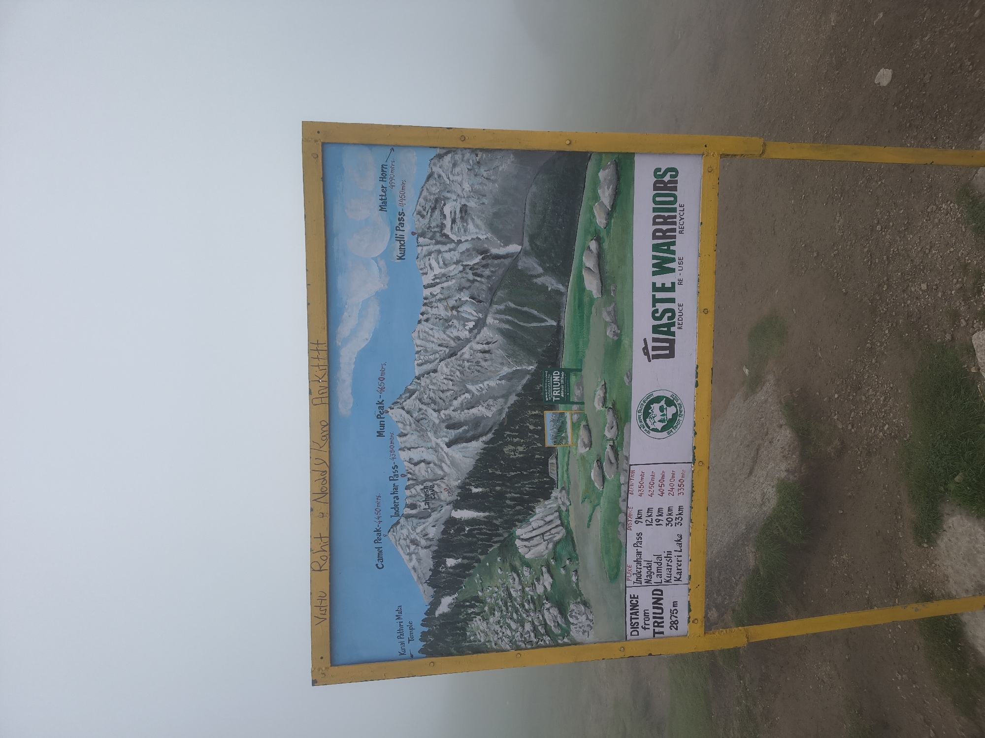
The media file is a photograph of a weather-worn sign at an outdoor location, likely a mountain trail in the Himalayas, given the context of Haini, India. The sign is primarily yellow with a painted illustration of a mountain landscape. The illustration depicts a rugged mountain range with snow-capped peaks, green slopes, and some rocky outcroppings. A winding path is visible ascending the mountain. Several labels identify points of interest on the map, including "Camel Peak," "Mun Peak," "Inderahar Pass," and "Kundli Pass," along with their altitudes in meters. "Matter Horn" is also labeled with its altitude. Below the illustration, a table lists "DISTANCE from TRIUND" to various places such as "Inderahar Pass," "Nagdal," "Lamdal," "Kuarshi," and "Kareri Lake," along with their respective distances and elevations. To the right of the illustrated map, there is a section with the heading "WASTE WARRIORS" and the words "REDUCE," "RE - USE," and "RECYCLE" printed vertically. There are also two circular emblems on the right side of the sign. Handwritten text is present vertically on the left side of the sign, which appears to be names: "Vistu," "Rohit," and "Noddy Kano Avikitttt." The sign is mounted on a yellow metal frame. The background of the image shows a misty, overcast sky, suggesting cool or damp weather and possibly a high altitude. The ground around the sign is rocky and covered with sparse grass. The overall impression is that of a trail marker providing information to hikers.
No transactions found