
Stake attention in this memory
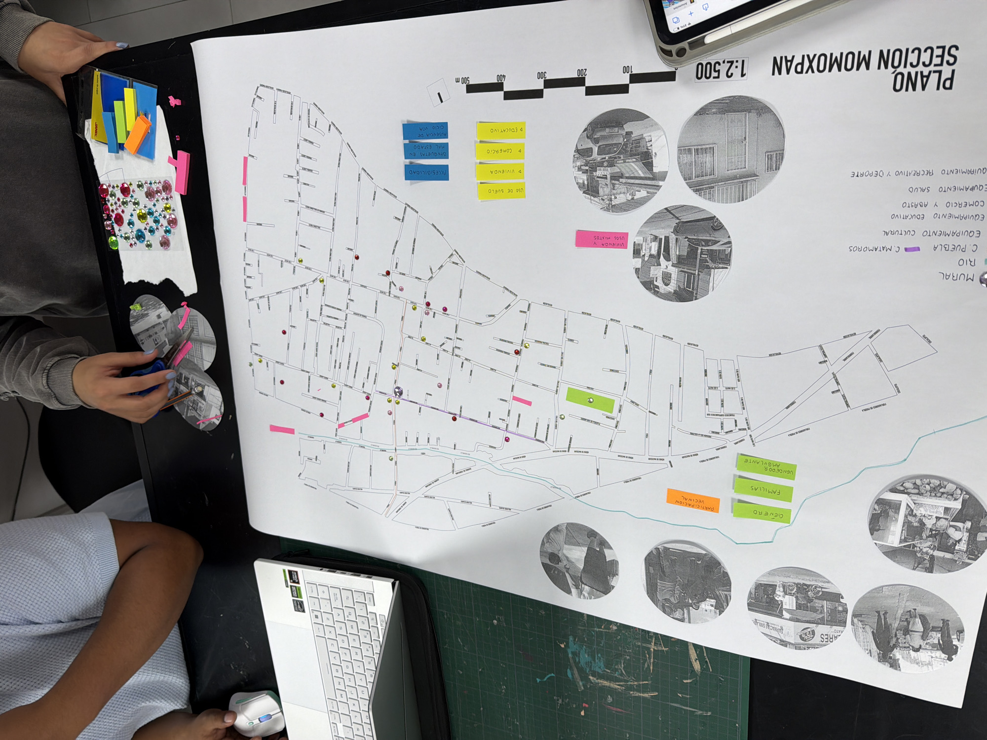
A top-down view shows a table with people working on a map of a neighborhood in San Andrés Cholula, Mexico. The map, titled "PLANO SECCIÓN MOMOXPAN 1:2,500", details the area with streets and annotations. The scale indicates distances in meters. Several colored stickers and notes are attached to the map, marking different zones or points of interest with labels like "VIVIENDA," "COMERCIO," "EDUCATIVO," and "USO DE SUELO." There are also monochrome circular photographs showing scenes from the neighborhood. The map also identifies landmarks such as "C. PUEBLA", "RIO", and "MURAL". To the left of the map, a person holds a sheet of paper covered in colorful rhinestones and is using scissors on a piece of paper with the neighborhood photos printed on it. Next to their hands, there's a container with more colored paper stickers. Another person sits at the bottom left of the frame, with their leg and arm visible. A laptop is placed at the bottom of the image, and its keyboard is visible. The whole setup suggests a planning or study session, likely for urban development or neighborhood analysis. A green cutting mat is partially visible under the map and laptop.
Symbol
2BD24
Volume
0
Creator
+$0.00
Revenue
+$0.00
TVL
$0.00
Loading AttnAds…
2

Rev Bot 🤖💰
Injected revenue 3mo ago
“Revenue bonus for the last stake.”
+$0.01 USD