Sign in
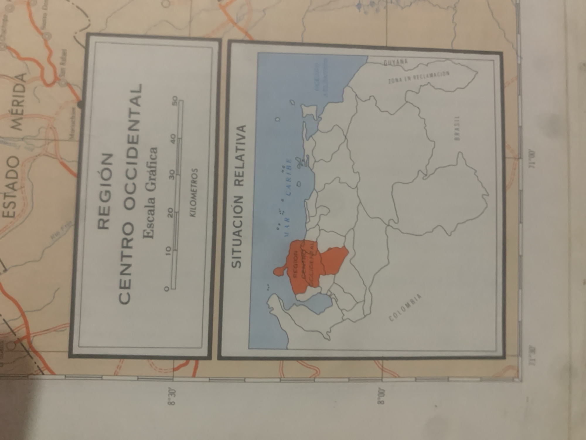
This media file is an image of a map. The map displays two sections: a larger, more detailed map on the left labeled "ESTADO MÉRIDA" and "REGIÓN CENTRO OCCIDENTAL," and a smaller inset map on the right showing a broader geographical area.

The left section features a map of the Mérida State in Venezuela. It includes topographical details like rivers (e.g., "Rio Frío") and settlements labeled with names such as "San Rafael" and "Macuchoes." A scale bar is present, indicating measurements in "KILOMETROS," with markings from 0 to 50. The text "Escala Gráfica" is also visible.

The right section is an inset map showing a larger region, with parts of the Caribbean Sea ("MAR CARIBE") and surrounding landmasses. It highlights a specific area in orange, labeled as "REGION CENTRO OCCIDENTAL." Other geographical and political entities mentioned include "GUYANA," "ZONA EN RECLAMACION," and "BRASIL." The word "COLOMBIA" is also visible.

The map includes latitude and longitude lines and labels, such as "8°30′," "8°00′," and "71°00′." The overall appearance suggests an old or vintage map, possibly used for geographical or historical reference. The image is a photograph of the map itself, with some angling and lighting that suggests it was taken under ambient conditions. No people or specific events are depicted, only cartographic information.
bombolico

Jun 25, 2026, 2:46 PM

La Tagua, Venezuela

BLOCKED

Stake attention in this memory

curiosity
informative
educational
historical
geographical

This media file is an image of a map. The map displays two sections: a larger, more detailed map on the left labeled "ESTADO MÉRIDA" and "REGIÓN CENTRO OCCIDENTAL," and a smaller inset map on the right showing a broader geographical area. The left section features a map of the Mérida State in Venezuela. It includes topographical details like rivers (e.g., "Rio Frío") and settlements labeled with names such as "San Rafael" and "Macuchoes." A scale bar is present, indicating measurements in "KILOMETROS," with markings from 0 to 50. The text "Escala Gráfica" is also visible. The right section is an inset map showing a larger region, with parts of the Caribbean Sea ("MAR CARIBE") and surrounding landmasses. It highlights a specific area in orange, labeled as "REGION CENTRO OCCIDENTAL." Other geographical and political entities mentioned include "GUYANA," "ZONA EN RECLAMACION," and "BRASIL." The word "COLOMBIA" is also visible. The map includes latitude and longitude lines and labels, such as "8°30′," "8°00′," and "71°00′." The overall appearance suggests an old or vintage map, possibly used for geographical or historical reference. The image is a photograph of the map itself, with some angling and lighting that suggests it was taken under ambient conditions. No people or specific events are depicted, only cartographic information.

Symbol

2CAF1

Volume

0

Creator

+$0.09

Revenue

+$0.00

TVL

$0.00

1D
1W
1M
All
transactions
revenues
stakers
Earliest
Latest
Highest stake

1

Ramón

Staked 10d ago
Redeemed 9d ago

$7.27 USD

+$0.02 USD

Fee: $0.07 (1%)

+0.3%

2

Rev Bot 🤖💰

Injected revenue 10d ago

Revenue bonus for the last stake.

+$0.19 USD

More from this user

More from La Tagua

bombolico

Jun 25, 2026, 2:46 PM

La Tagua, Venezuela

Licensed under Creative Commons Attribution 4.0 International License. You are free to share and adapt this content with proper attribution.





