Sign in
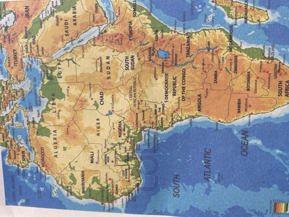
This image is a photograph of a political and physical map primarily depicting the continent of Africa, with portions of Europe and Asia visible at the top and right. The scene is not a physical location in Accra, Ghana, but rather a printed map where Accra, Ghana, is marked as a red dot on the southern coast of the country of Ghana in West Africa.

The map details national borders, country names (e.g., Algeria, Niger, Sudan, Nigeria, Ghana, Democratic Republic of the Congo, South Africa, Spain, Turkey, Saudi Arabia), and major cities, which are indicated by red dots and accompanying labels (e.g., Accra, Abuja, Khartoum, Cairo, Madrid, Rome, Athens, Ankara, Riyadh). Bodies of water, including the North Atlantic Ocean, South Atlantic Ocean, Mediterranean Sea, and Red Sea, are labeled in blue. Topographical features are represented through varying shades of green for lower elevations and brown/tan for higher elevations and deserts. A faint "COLOURBOX" watermark is visible across the map, particularly over West Africa. The photograph captures a physical map, likely a page from an atlas or a laminated chart, with slight texture visible on the surface. No people, active scenes, or direct interactions are depicted.
King Legend

Dec 4, 2025, 2:15 PM

Accra, Ghana

Stake attention in this memory

Educational
Geographic
Historical
Informative
Nostalgic

This image is a photograph of a political and physical map primarily depicting the continent of Africa, with portions of Europe and Asia visible at the top and right. The scene is not a physical location in Accra, Ghana, but rather a printed map where Accra, Ghana, is marked as a red dot on the southern coast of the country of Ghana in West Africa. The map details national borders, country names (e.g., Algeria, Niger, Sudan, Nigeria, Ghana, Democratic Republic of the Congo, South Africa, Spain, Turkey, Saudi Arabia), and major cities, which are indicated by red dots and accompanying labels (e.g., Accra, Abuja, Khartoum, Cairo, Madrid, Rome, Athens, Ankara, Riyadh). Bodies of water, including the North Atlantic Ocean, South Atlantic Ocean, Mediterranean Sea, and Red Sea, are labeled in blue. Topographical features are represented through varying shades of green for lower elevations and brown/tan for higher elevations and deserts. A faint "COLOURBOX" watermark is visible across the map, particularly over West Africa. The photograph captures a physical map, likely a page from an atlas or a laminated chart, with slight texture visible on the surface. No people, active scenes, or direct interactions are depicted.

Loading AttnAds…

transactions
revenues
stakers
Earliest
Latest
Highest stake

No transactions found

More from this user

More from Accra

King Legend

Dec 4, 2025, 2:15 PM

Accra, Ghana

Licensed under Creative Commons Attribution 4.0 International License. You are free to share and adapt this content with proper attribution.