
Stake attention in this memory
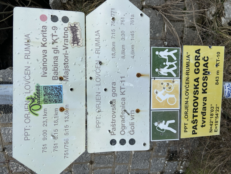
The image displays a weathered hiking trail signpost situated outdoors, likely in a mountainous or hilly area of Montenegro, specifically identified by coordinates N=42°18'03'' E=18°54'22'' as Paštrovska Gora, near Tvrđava Kosmač, in proximity to Rafailovići. The scene is dominated by multiple informational signs attached to a central metal pole, viewed from a slightly upward angle against a background of a stone wall on the left and dry, sparse vegetation on the right. The uppermost sign is an arrow-shaped white panel pointing left, labeled "PPT: ORJEN - LOVĆEN - RUMIJA." It lists three destinations with associated times and distances: "Ivanova Korita" (9:00, 23,1km), "Babina gl. KT-9" (6:15, 16,1km), and "Majstori-Vratno" (5:15, 13,5km). A green "Outdoor Montenegro" logo with a QR code is affixed to the left side, and a small, illegible black sticker with a stylized logo is present on the right. The surface of this sign shows multiple small bullet-like indentations and water droplets. Several rusted screws are visible, attaching it to the pole. Below it, a second identical arrow-shaped white sign points right, also labeled "PPT: ORJEN - LOVĆEN - RUMIJA." This sign lists three additional destinations: "Paštrovska gora" (18,6km, 7:15, 760/771), "Ograđenica KT-11" (8,8km, 3:30, 761), and "Goli vrh" (4,6km, 1:45, 761a). This sign also exhibits surface wear, indentations, and water droplets, with visible rusted screws. Beneath these, three square pictographic signs are arranged horizontally. From left to right: a white silhouette of a hiker with a backpack on a green background, a white silhouette of a cyclist on a bicycle on a yellow background, and a white silhouette of a family (two adults and a child) hiking on a green background. These signs also show minor wear. The lowest sign is a rectangular yellow panel with black text, stating "PPT „ORJEN-LOVĆEN-RUMIJA“" at the top. Below this, it reads "PAŠTROVSKA GORA" and "tvrđava KOSMAČ." At the bottom, geographic coordinates N=42°18'03'' E=18°54'22'' are displayed, along with "843 m KT-10," indicating the altitude and a trail marker. This yellow sign appears less weathered than the white signs. All signs are functional, providing navigational information for various outdoor activities, and no people are present in the frame. The overall impression is one of a maintained but exposed trail marker in a natural environment.
Loading AttnAds…
No transactions found