Stake attention in this memory
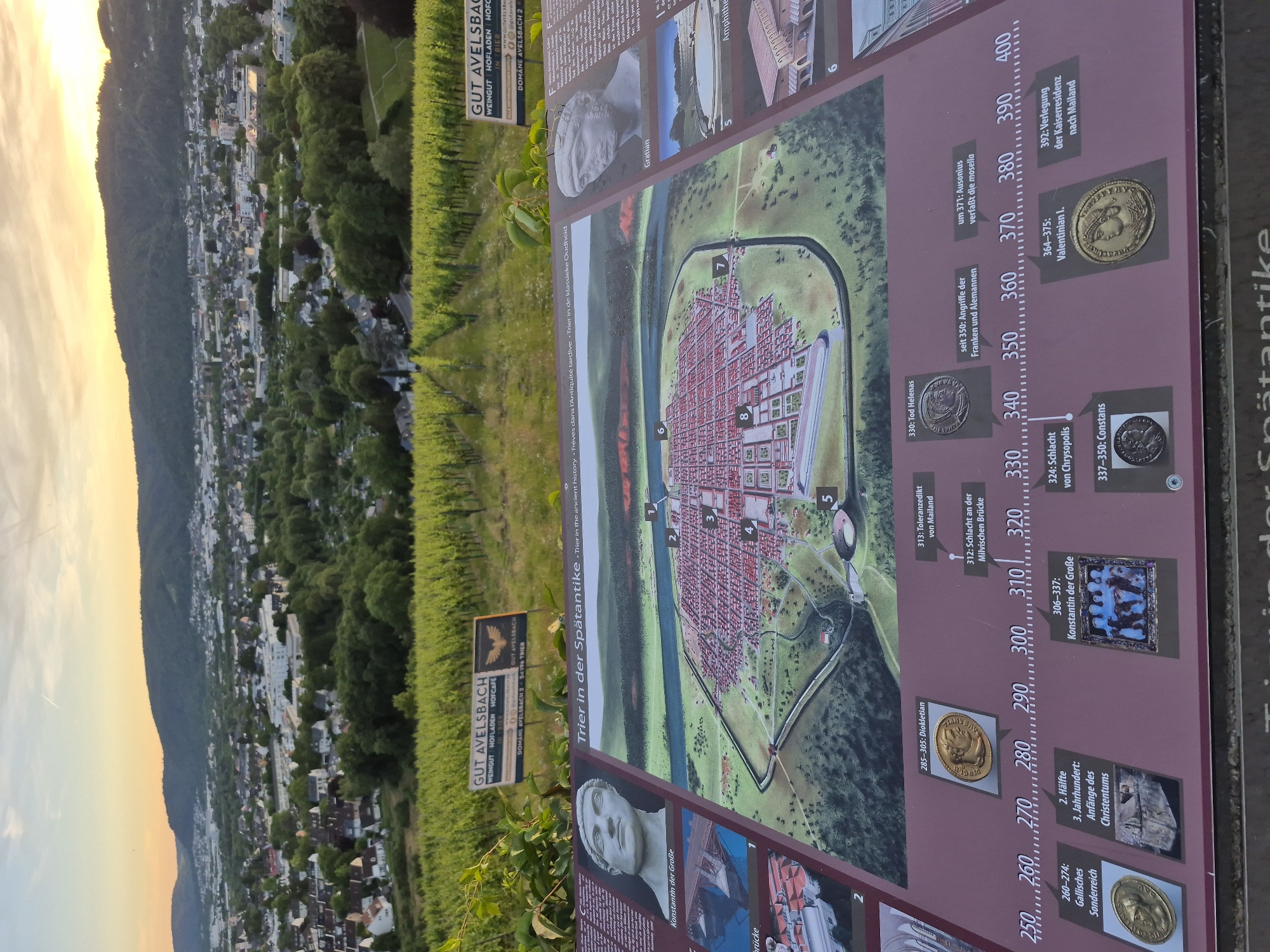
An eye-level, medium shot captures an informational display board with a historical map of Trier, Germany, set against a backdrop of a sprawling cityscape nestled in a valley, framed by lush green vineyards in the foreground. The display board, made of metal and positioned horizontally, features a detailed illustration of the ancient Roman city of Trier during late antiquity. The map is surrounded by portraits of historical figures, images of artifacts, and a timeline with dates and corresponding events. To the left of the map, a bust of Emperor Constantine the Great is depicted, with text below in German, "Konstantin der Große." Below this, an illustration shows what appears to be a Roman bridge. On the right side of the map, another bust labeled "Gratian" is visible, followed by an illustration of the Imperial Baths and an amphitheater. The timeline stretches across the bottom of the display, marking significant years from 250 to 400 AD, with accompanying text in German detailing events such as the "Gallic Sonderreich" (Gallic Empire), the "Anfänge des Christentums" (Beginnings of Christianity), and the "Verlegung der Kaiseresidenz nach Mailand" (Relocation of the Imperial Residence to Milan). Behind the display, rows of green grapevines stretch up a hillside, indicative of a vineyard. In the distance, the city of Trier unfolds, with a mix of residential buildings, commercial structures, and churches, all bathed in the warm glow of what appears to be a sunset or sunrise. Hills covered in dense vegetation form the horizon. Two signs for "GUT AVELSBACH" are visible above the vineyards. The overall scene is bright and clear, suggesting daytime. No people are present in the frame.
No transactions found