
Sign in
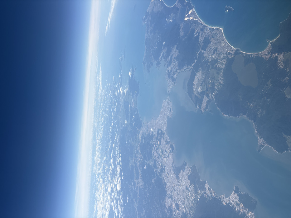
The image displays a high-altitude aerial perspective under bright daylight conditions. The upper approximately 40% of the frame features a clear, deep blue sky, gradually fading to a lighter azure near the horizon. A thin, horizontal band of atmospheric haze or very high, wispy clouds is visible at the distant horizon line, beneath which scattered white cumulus clouds are distributed over land and water.

The terrain below is a complex coastal landscape, dominated by a large, irregularly shaped island situated centrally and separated from a mainland by two narrow water channels, forming a distinctive bay system. Extensive urban development is visible, appearing as dense networks of light-colored buildings concentrated along the coastlines of the main island and the adjacent mainland. Numerous smaller islands are interspersed throughout the expansive bay.

A prominent airfield, characterized by at least one discernible runway and associated infrastructure, is located on the southern part of the main island, bordering the water. Significant portions of the landmasses are covered by dense green vegetation, indicative of forests or hilly terrain, alongside several darker, inland water bodies, including a notably large lake on the central island. Sandy beaches are observable along the eastern coastlines of both the primary island and the mainland.

The identifiable geographical location depicted is Florianópolis, Brazil, encompassing Santa Catarina Island and its surrounding coastal areas.
luciannex

Dec 15, 2025, 12:59 PM

Aeropuerto Internacional Ezeiza, Argentina

Moment

Stake attention in this memory

Awe
Wonder
Serenity
Peace
Inspiration

The image displays a high-altitude aerial perspective under bright daylight conditions. The upper approximately 40% of the frame features a clear, deep blue sky, gradually fading to a lighter azure near the horizon. A thin, horizontal band of atmospheric haze or very high, wispy clouds is visible at the distant horizon line, beneath which scattered white cumulus clouds are distributed over land and water. The terrain below is a complex coastal landscape, dominated by a large, irregularly shaped island situated centrally and separated from a mainland by two narrow water channels, forming a distinctive bay system. Extensive urban development is visible, appearing as dense networks of light-colored buildings concentrated along the coastlines of the main island and the adjacent mainland. Numerous smaller islands are interspersed throughout the expansive bay. A prominent airfield, characterized by at least one discernible runway and associated infrastructure, is located on the southern part of the main island, bordering the water. Significant portions of the landmasses are covered by dense green vegetation, indicative of forests or hilly terrain, alongside several darker, inland water bodies, including a notably large lake on the central island. Sandy beaches are observable along the eastern coastlines of both the primary island and the mainland. The identifiable geographical location depicted is Florianópolis, Brazil, encompassing Santa Catarina Island and its surrounding coastal areas.

Symbol

2E2C4

Volume

8,469

Creator

+$0.06

Revenue

+$0.10

TVL

$1.54

1D
1W
1M
All

Loading AttnAds…

transactions
revenues
stakers
Earliest
Latest
Highest stake

1

CM🤖

Staked 6mo ago

$1.40 USD

+$0.08 USD

+6%

3

TAGBOT🤖🏷

Staked 6mo ago

$0.03 USD

+$0.00 USD

+4%

2

TAGBOT🤖🏷

Staked 6mo ago

$0.03 USD

+$0.00 USD

+4%

4

lebronholc

Staked 6mo ago
Redeemed 6mo ago

$2.80 USD

+$0.05 USD

Fee: $0.01 (0.5%)

+2%

5

Rev Bot 🤖💰

Injected revenue 6mo ago

Revenue bonus for the last stake.

+$0.21 USD

More from this user

More from Aeropuerto Internacional Ezeiza

luciannex

Dec 15, 2025, 12:59 PM

Aeropuerto Internacional Ezeiza, Argentina

Licensed under Creative Commons Attribution 4.0 International License. You are free to share and adapt this content with proper attribution.