Stake attention in this memory
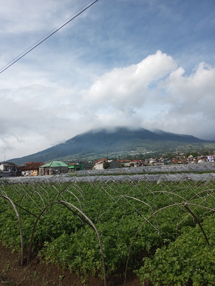
The image depicts a panoramic landscape taken from Salai Har Htan, Myanmar. In the foreground, an extensive agricultural field is visible, featuring rows of dense green plants, consistent with a leafy vegetable crop. Numerous arched metal or wooden support frames, likely for protective netting or covers, are systematically arranged across the field, with some sections showing translucent white material partially deployed. The soil appears dark brown. No individuals are present in this section. The midground reveals a settlement or village nestled at the base of a mountain. It comprises various single and multi-story buildings with diverse roofing materials, including red tiles, grey sheets, and one notable structure with a bright green roof. A mosque with a visible dome and minaret can be discerned towards the right side of the settlement. Dominating the background is a large, heavily vegetated mountain, its peak and upper slopes partially obscured by a thick layer of white and grey clouds. The lower slopes are densely forested. The sky above is partly cloudy, displaying patches of clear blue amidst scattered white cumulus formations. A single, dark overhead power line or utility cable stretches diagonally across the upper left quadrant of the frame. The overall environment suggests a rural mountainous region with active agriculture.
Symbol
2F1A9
Volume
1,018
Creator
+$0.06
Revenue
+$0.00
TVL
$0.44