
Sign in
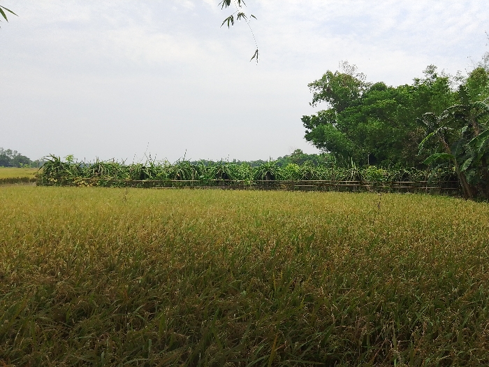
The image shows a field of tall, green grass, possibly rice paddy, located in Khoria, Bangladesh, at latitude 24.025 and longitude 90.723.  A line of bushes and trees separates the field from a road or path beyond.  The sky is overcast, with a light breeze blowing through the grass.  The image was taken from a slightly elevated vantage point, likely a road or path, giving a broad perspective of the scene.  The image appears to be taken during the daytime, with no people visible. The presence of a fence suggests a cultivated area with a possible nearby village or homestead.
FM-7LERp2

May 2, 2025, 5:55 AM

Khoria, Bangladesh

Stake attention in this memory

tranquil
peaceful
serene
rural
natural

The image shows a field of tall, green grass, possibly rice paddy, located in Khoria, Bangladesh, at latitude 24.025 and longitude 90.723. A line of bushes and trees separates the field from a road or path beyond. The sky is overcast, with a light breeze blowing through the grass. The image was taken from a slightly elevated vantage point, likely a road or path, giving a broad perspective of the scene. The image appears to be taken during the daytime, with no people visible. The presence of a fence suggests a cultivated area with a possible nearby village or homestead.

Loading AttnAds…

transactions
revenues
stakers
Earliest
Latest
Highest stake

No transactions found
More from this user

More from Khoria

FM-7LERp2

May 2, 2025, 5:55 AM

Khoria, Bangladesh

Licensed under Creative Commons Attribution 4.0 International License. You are free to share and adapt this content with proper attribution.