Sign in
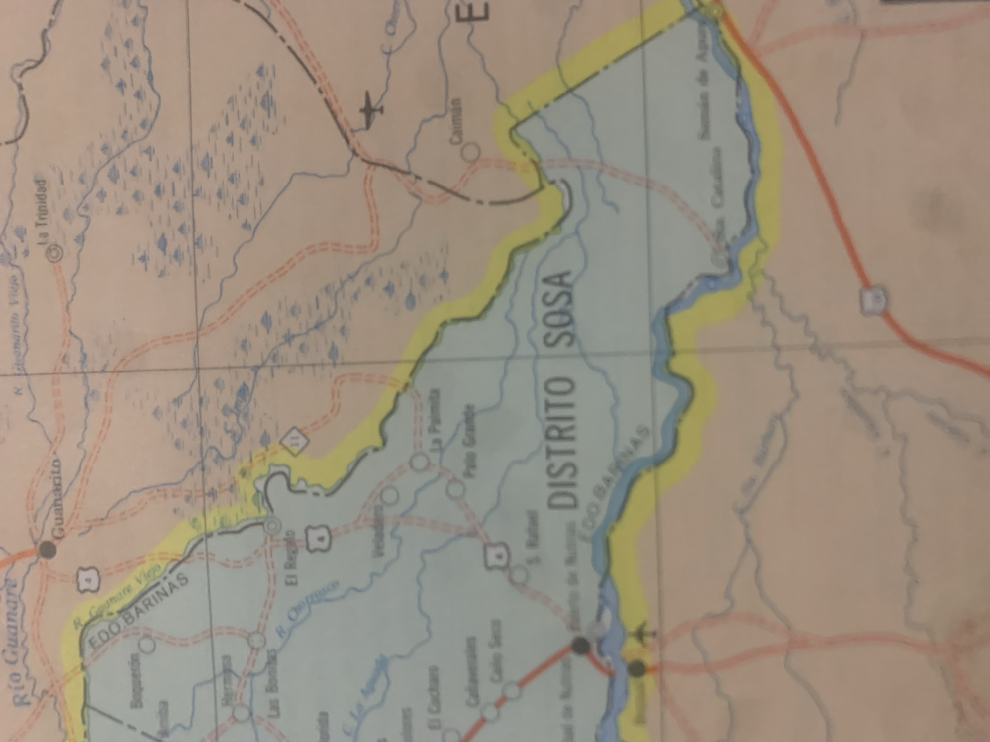
The image is a close-up, rotated view of a section of a map of Venezuela, likely an old paper map given the color saturation and texture. The map depicts geographical features such as rivers, roads, and possibly marshy or lake-like areas indicated by blue triangular shapes. Several place names are clearly visible in Spanish, including "Río Guanare," "Guanarito," "La Trinidad," "EDO BARINAS," "DISTRITO SOSA," and others like "Caiman," "La Palmita," and "Palo Grande."

Roads are marked with red lines, some with dashed lines, and at least one highway is indicated by a numbered shield symbol. There are also symbols representing an airplane and what appears to be a settlement. The primary focus of the visible portion of the map is the region around "EDO BARINAS" and "DISTRITO SOSA," with a significant river or body of water highlighted in blue and bordered by a yellow outline. The overall scene is a static representation of a geographical area, with no people, activity, or specific time of day or weather conditions depicted. The text present consists entirely of place names and labels related to geography and administrative divisions.
bombolico

Jun 25, 2026, 2:48 PM

La Tagua, Venezuela

BLOCKED

Stake attention in this memory

nostalgic
analytical
curious
somber
reflective

The image is a close-up, rotated view of a section of a map of Venezuela, likely an old paper map given the color saturation and texture. The map depicts geographical features such as rivers, roads, and possibly marshy or lake-like areas indicated by blue triangular shapes. Several place names are clearly visible in Spanish, including "Río Guanare," "Guanarito," "La Trinidad," "EDO BARINAS," "DISTRITO SOSA," and others like "Caiman," "La Palmita," and "Palo Grande." Roads are marked with red lines, some with dashed lines, and at least one highway is indicated by a numbered shield symbol. There are also symbols representing an airplane and what appears to be a settlement. The primary focus of the visible portion of the map is the region around "EDO BARINAS" and "DISTRITO SOSA," with a significant river or body of water highlighted in blue and bordered by a yellow outline. The overall scene is a static representation of a geographical area, with no people, activity, or specific time of day or weather conditions depicted. The text present consists entirely of place names and labels related to geography and administrative divisions.

Symbol

3111F

Volume

11,550

Creator

+$0.09

Revenue

+$0.19

TVL

$7.47

1D
1W
1M
All
transactions
revenues
stakers
Earliest
Latest
Highest stake

1

RIKO

Staked 10d ago

$7.35 USD

+$0.12 USD

+2%

2

Rev Bot 🤖💰

Injected revenue 10d ago

Revenue bonus for the last stake.

+$0.21 USD

More from this user

More from La Tagua

bombolico

Jun 25, 2026, 2:48 PM

La Tagua, Venezuela

Licensed under Creative Commons Attribution 4.0 International License. You are free to share and adapt this content with proper attribution.