Sign in
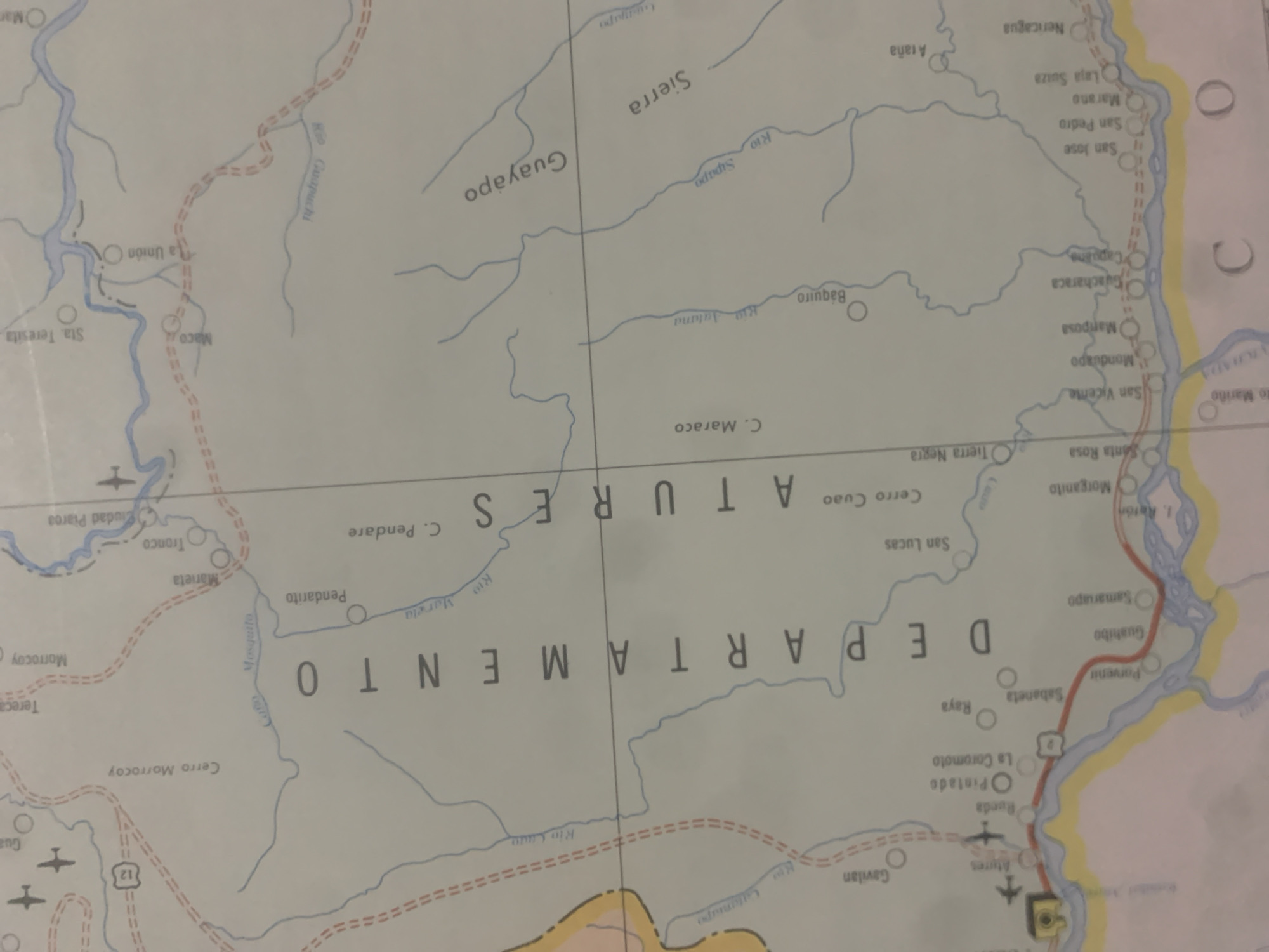
This is an image of a map of the Atures department in Venezuela, likely a regional map due to the presence of rivers, towns, and geographical features. The map is oriented with the top of the image tilted towards the left.

The visible text includes names of locations such as "Atures," "DEPARTAMENTO," and various towns and rivers like "Guayapo," "Sierra," "Rio Sipapo," "C. Maraco," "Pendarito," "San Lucas," "Santa Rosa," "San Vicente," "Monduapo," "Mamposa," "Guacharaca," "Capuane," "San Pedro," "San Jose," "Marano," "Laja Suiza," "Nericagua," "Atana," "Rio Guapuchi," "Mosquito," "C. Pendare," "Marieta," "Tronco," "Ciudad Piarca," "Morrocoy," "Cerro Morrocoy," "Tereca," "Sta. Teresita," "Maco," "La Unión," "Rio Jatana," "Báquiro," "San Juan," "Raya," "Sabaneta," "Parvenir," "Guahibo," "Samariapo," "La Coromoto," "Pintado," "Rueda," "Gavilan," "Rio Cado," and "1. Ratón." There are also road markings represented by dashed red lines and a symbol indicating an airport with an airplane. Some areas of the map are colored yellow and light brown, suggesting bordering regions or different types of terrain. The map appears to be printed on paper. No people or specific activities are depicted.
bombolico

Jun 25, 2026, 2:49 PM

La Tagua, Venezuela

BLOCKED

Stake attention in this memory

curiosity
exploration
adventure
nostalgia
planning

This is an image of a map of the Atures department in Venezuela, likely a regional map due to the presence of rivers, towns, and geographical features. The map is oriented with the top of the image tilted towards the left. The visible text includes names of locations such as "Atures," "DEPARTAMENTO," and various towns and rivers like "Guayapo," "Sierra," "Rio Sipapo," "C. Maraco," "Pendarito," "San Lucas," "Santa Rosa," "San Vicente," "Monduapo," "Mamposa," "Guacharaca," "Capuane," "San Pedro," "San Jose," "Marano," "Laja Suiza," "Nericagua," "Atana," "Rio Guapuchi," "Mosquito," "C. Pendare," "Marieta," "Tronco," "Ciudad Piarca," "Morrocoy," "Cerro Morrocoy," "Tereca," "Sta. Teresita," "Maco," "La Unión," "Rio Jatana," "Báquiro," "San Juan," "Raya," "Sabaneta," "Parvenir," "Guahibo," "Samariapo," "La Coromoto," "Pintado," "Rueda," "Gavilan," "Rio Cado," and "1. Ratón." There are also road markings represented by dashed red lines and a symbol indicating an airport with an airplane. Some areas of the map are colored yellow and light brown, suggesting bordering regions or different types of terrain. The map appears to be printed on paper. No people or specific activities are depicted.

Symbol

3150D

Volume

11,550

Creator

+$0.09

Revenue

+$0.12

TVL

$7.39

1D
1W
1M
All
transactions
revenues
stakers
Earliest
Latest
Highest stake

1

RIKO

Staked 10d ago

$7.35 USD

+$0.05 USD

+0.6%

2

Rev Bot 🤖💰

Injected revenue 10d ago

Revenue bonus for the last stake.

+$0.13 USD

More from this user

More from La Tagua

bombolico

Jun 25, 2026, 2:49 PM

La Tagua, Venezuela

Licensed under Creative Commons Attribution 4.0 International License. You are free to share and adapt this content with proper attribution.