Stake attention in this memory
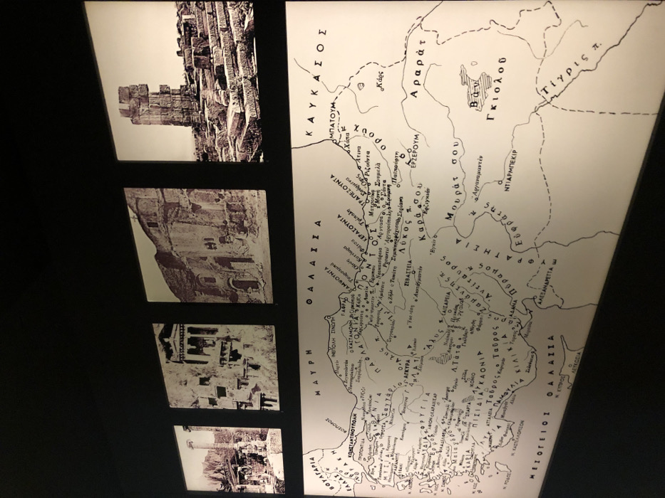
This image captures a museum or exhibition display featuring a historical map and five sepia-toned photographs of ancient ruins. The map, rendered in black and white with Greek text, depicts the geographical region of Anatolia (modern-day Turkey), extending into the Caucasus, parts of the Black Sea, and the Eastern Mediterranean. Visible place names on the map include major cities and geographical features: ΚΩΝΣΤΑΝΤΙΝΟΥΠΟΛΗ (Constantinople), ΤΡΑΠΕΖΟΥΝΤΑ (Trabzon), ΑΓΚΥΡΑ (Ankara), ΣΕΒΑΣΤΕΙΑ (Sivas), ΕΡΖΕΡΟΥΜ (Erzurum), ΝΤΙΑΡΜΠΕΚΙΡ (Diyarbakır), and ΚΑΥΚΑΣΟΣ (Caucasus) mountains. Seas are labeled as ΜΑΥΡΗ ΘΑΛΑΣΣΑ (Black Sea) and ΜΕΣΟΓΕΙΟΙ ΘΑΛΑΣΣΑ (Mediterranean Sea). Other notable labels include Αραράτ (Mount Ararat), the Τίγρις π. (Tigris River), Ευφράτης (Euphrates River), and Βαν Γκιολού (Lake Van). Specific historical sites like Μονή Σουμελά (Sumela Monastery) are also marked. The map indicates historical regions and cities, suggesting a focus on the Greek presence or historical geography of these areas. To the left of the map, arranged vertically, are five framed, sepia-toned photographs. These images showcase various ancient structures and ruins. From top to bottom: 1. A fortified structure or part of a castle, built with large stone blocks. 2. Rock-cut dwellings or monasteries carved into a cliff face. 3. Extensive ruins of a large building complex, possibly a temple or a basilica, showing columns and multiple levels. 4. More rock-hewn structures, similar to the second photograph, possibly indicating cave churches or habitations. 5. A prominent standing column amidst surrounding architectural debris, suggesting a temple or a public building. The overall display highlights historical sites and the broader geographical context, likely emphasizing cultural heritage or historical periods related to the regions shown on the map. The black background suggests an illuminated display in an indoor setting.
No transactions found