
Sign in
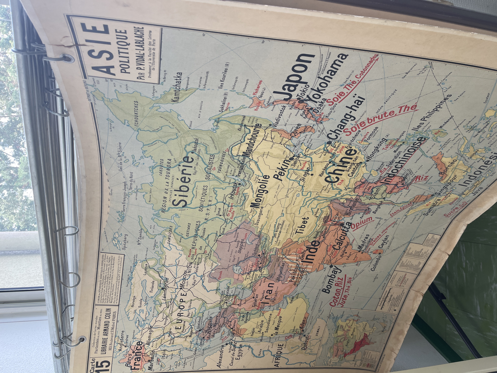
A vintage political wall map of Asia is the central subject, hanging indoors against a window. The map, titled "ASIE POLITIQUE PAR P. VIDAL-LABLACHE Professeur à la Faculté des Lettres de l'Université de Paris," shows signs of age with yellowing paper and some creases. It is secured at the top by a series of metal rings threaded onto a multi-barreled metal rod, a common method for educational wall charts.

The map details the geographical and political divisions of Asia, including countries like "Japon," "Chine," "Inde," "URSS," "Iran," and "Afghanistan," along with surrounding regions of Europe and Africa. Numerous cities are labeled, such as "Tokyo," "Pékin," "Bombay," "Calcutta," and "Alexandrie." Red text highlights various resources and products across the continent, including "Soie" (silk), "Thé" (tea), "Riz" (rice), "Pétrole" (oil), "Houille" (coal), "Opium," and "Coton." A section on the lower left identifies the publisher as "LIBRAIRIE ARMAND COLIN" in Paris and notes it as "Carte 15" from a collection of "Cartes murales Parlantes au recto Muettes au verso" (talking on the front, blank on the back).

Natural daylight from the window illuminates the scene, casting light on the map and revealing blurred green foliage from trees outside. The setting implies an indoor space, possibly a classroom or office, where the map is displayed. No activity or event is depicted, only the static presentation of the map.
josi😉

Apr 30, 2026, 11:26 AM

La Fouillouse, France

Stake attention in this memory

nostalgic
educational
historical
informative
curious

A vintage political wall map of Asia is the central subject, hanging indoors against a window. The map, titled "ASIE POLITIQUE PAR P. VIDAL-LABLACHE Professeur à la Faculté des Lettres de l'Université de Paris," shows signs of age with yellowing paper and some creases. It is secured at the top by a series of metal rings threaded onto a multi-barreled metal rod, a common method for educational wall charts. The map details the geographical and political divisions of Asia, including countries like "Japon," "Chine," "Inde," "URSS," "Iran," and "Afghanistan," along with surrounding regions of Europe and Africa. Numerous cities are labeled, such as "Tokyo," "Pékin," "Bombay," "Calcutta," and "Alexandrie." Red text highlights various resources and products across the continent, including "Soie" (silk), "Thé" (tea), "Riz" (rice), "Pétrole" (oil), "Houille" (coal), "Opium," and "Coton." A section on the lower left identifies the publisher as "LIBRAIRIE ARMAND COLIN" in Paris and notes it as "Carte 15" from a collection of "Cartes murales Parlantes au recto Muettes au verso" (talking on the front, blank on the back). Natural daylight from the window illuminates the scene, casting light on the map and revealing blurred green foliage from trees outside. The setting implies an indoor space, possibly a classroom or office, where the map is displayed. No activity or event is depicted, only the static presentation of the map.

Loading AttnAds…

transactions
revenues
stakers
Earliest
Latest
Highest stake

No transactions found

More from this user

More from La Fouillouse

josi😉

Apr 30, 2026, 11:26 AM

La Fouillouse, France

Licensed under Creative Commons Attribution 4.0 International License. You are free to share and adapt this content with proper attribution.