Stake attention in this memory
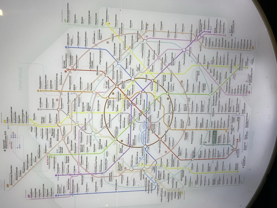
This image captures a physical map of the Moscow Metro system, likely displayed in a public area, as indicated by the noticeable glare and slight photographic tilt. The map is a detailed representation of the metro network, featuring various colored lines to distinguish different routes, with numbered circles identifying each line. Station names are clearly labeled in Cyrillic script along these lines, and transfer points between different lines are marked by interconnected circles. The central portion of the map showcases the intricate urban metro system, including the prominent Koltsevaya Line (Circle Line). The map extends to depict suburban regions, explicitly labeled as "ПРИГОРОД" (Suburbs) in several instances. It also highlights critical connections to Moscow's international airports: Sheremetyevo (SVO), Domodedovo (DME), and Vnukovo (ZIA). Other visible text includes "Железнодорожная" (Railway), indicating integrated rail services, and specific station names such as "Лубянка", "Киевская", "ВДНХ", and "Парк Культуры". The map serves as a navigational tool for Moscow's extensive public transportation system.
Loading AttnAds…
No transactions found