
Sign in
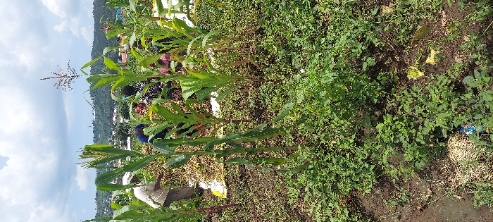
The image shows a field of tall, green corn plants in a rural area of Mbeya, Tanzania. The GPS coordinates (latitude: -8.933, longitude: 33.422) place the location in the Mbeya Region. The field is relatively flat, with a dirt path running through it. Several people are working in the field, harvesting the corn. Some of the people are bent over, picking corn cobs from the stalks, while others are carrying baskets of harvested corn. There is a patch of smaller plants in the foreground, and a hillside in the background. The sky is partly cloudy, with patches of blue showing through.  The scene shows a typical day in a Tanzanian village, with people engaged in agricultural labor.
FM-22tvy2

Feb 27, 2025, 9:50 AM

Mbeya, Tanzania

Stake attention in this memory

Tranquil
Serene
Natural
Peaceful
Labor

The image shows a field of tall, green corn plants in a rural area of Mbeya, Tanzania. The GPS coordinates (latitude: -8.933, longitude: 33.422) place the location in the Mbeya Region. The field is relatively flat, with a dirt path running through it. Several people are working in the field, harvesting the corn. Some of the people are bent over, picking corn cobs from the stalks, while others are carrying baskets of harvested corn. There is a patch of smaller plants in the foreground, and a hillside in the background. The sky is partly cloudy, with patches of blue showing through. The scene shows a typical day in a Tanzanian village, with people engaged in agricultural labor.

Loading AttnAds…

transactions
revenues
stakers
Earliest
Latest
Highest stake

No transactions found

More from this user

More from Mbeya

FM-22tvy2

Feb 27, 2025, 9:50 AM

Mbeya, Tanzania

Licensed under Creative Commons Attribution 4.0 International License. You are free to share and adapt this content with proper attribution.