Stake attention in this memory
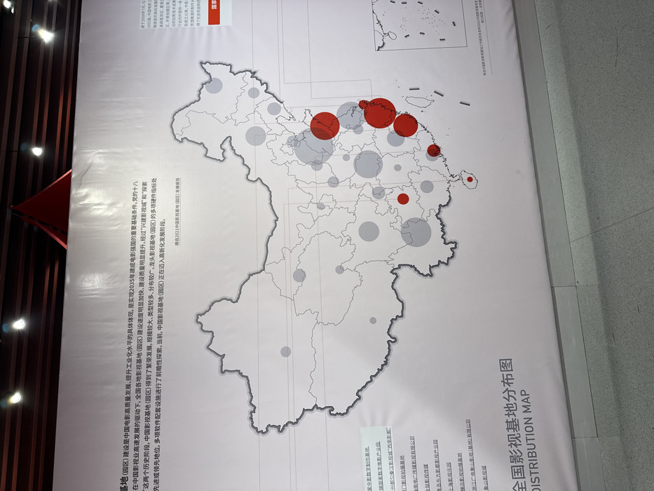
The image shows a large map of China, with a title that reads "全国初期基地分布图", which translates to "National Initial Base Distribution Map". The map is displayed on a wall in a building, likely an exhibition hall. The map is white with black lines outlining the provinces and regions of China. The map has a red outline and contains both red and gray circles of different sizes, with the red circles located in the eastern and southeastern coastal regions. The location of the image based on the coordinates is the Beijing Convention and Exhibition Center, located in the Chaoyang District of Beijing, China. The environment is an indoor space with a white tiled floor. There are no people visible in the image.
No transactions found