Stake attention in this memory
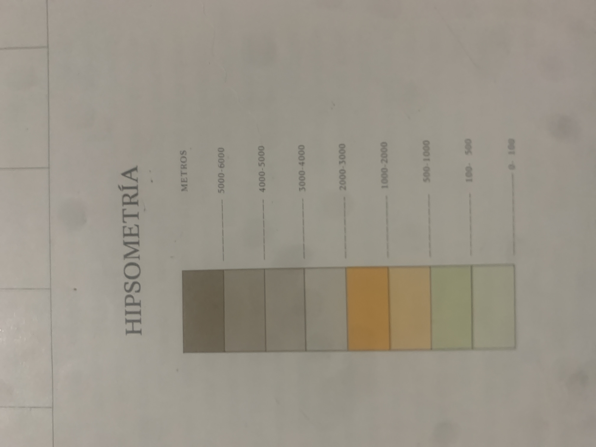
This media file is an image of a legend or color key for a map, likely a hypsometric map, indicating elevation ranges. The title "HIPSOMETRÍA" is prominently displayed vertically on the left side. Below the title, "METROS" is written horizontally, indicating the unit of measurement. The legend consists of a series of colored rectangles, each corresponding to a different elevation range. The ranges are marked with numerical values above and to the left of the rectangles: - 5000-6000 - 4000-5000 - 3000-4000 - 2000-3000 - 1000-2000 - 500-1000 - 100-500 - 0-100 The colors progress from darker shades of gray at higher elevations to lighter shades of gray, then to orange and yellow hues, and finally to light green and pale green for lower elevations. The image appears to be a photograph of a printed document, possibly taken indoors under artificial lighting, as indicated by the slight glare and shadow. There are no people or animals visible. The setting is likely a workspace or an office where map-related materials are kept. The file does not provide explicit location cues for La Tagua, Venezuela, but the presence of a hypsometric legend suggests its use in geographical or cartographic contexts related to that region.
Symbol
36499
Volume
11,550
Creator
+$0.13
Revenue
+$0.17
TVL
$11.55
2
Rev Bot 🤖💰
Injected revenue 6d ago
“Revenue bonus for the last stake.”
+$0.18 USD


