
Stake attention in this memory
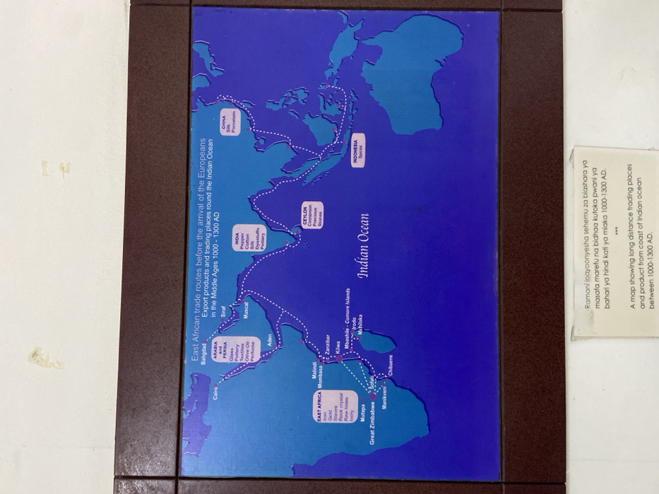
A map depicting East African trade routes before the arrival of Europeans. The map is framed and mounted on a white wall. The map is titled “East African trade routes before the arrival of the Europeans. Export products and trading places round the Indian Ocean in the Middle Ages 1000 - 1300 AD.” The map shows a map of Africa, the Indian Ocean, and parts of Asia. The map details the trade routes and various goods exported from the different locations, including spices, gold, ivory, and slaves. There is an inscription below the map in Swahili and English. The inscription in Swahili reads “Ramani inayoonyesha sehemu za biashara ya masafa marefu na bidhaa kutokea pwani ya bahari ya hindi kati ya miaka 1000-1300 AD.” The English inscription reads “A map showing long distance trading places and product from coast of Indian ocean between 1000-1300 AD.” The map is located at the National Museum of Tanzania in Dar es Salaam, Tanzania. The latitude and longitude coordinates of the museum are -6.814, 39.294.
Loading AttnAds…
No transactions found