
Sign in
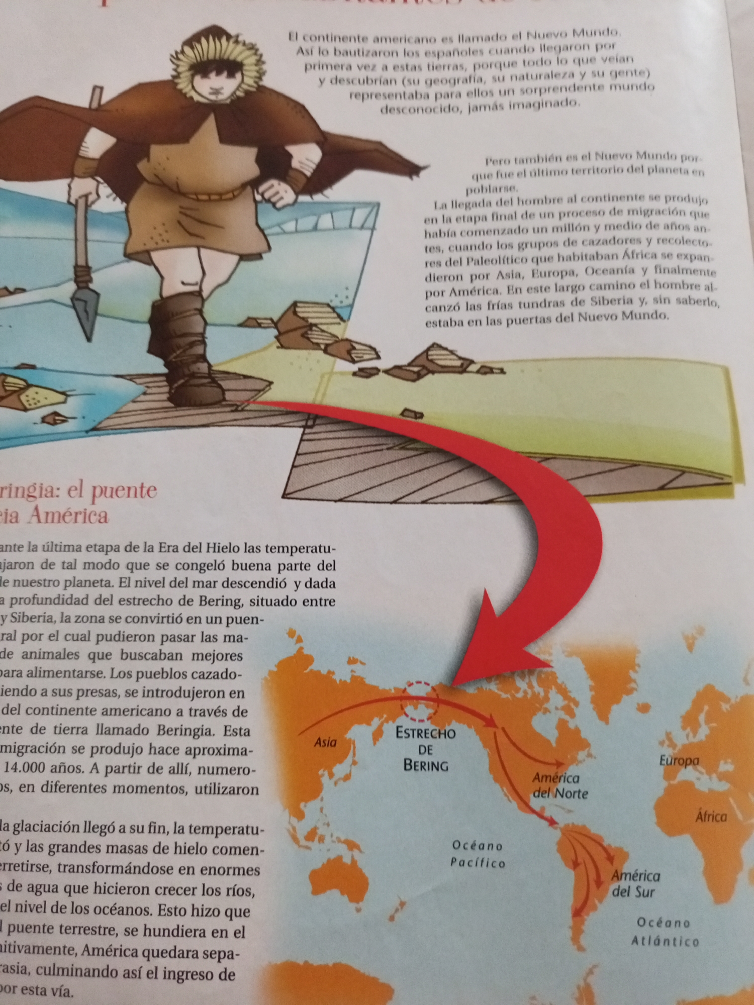
This media file is an illustration from a book, likely a children's history or geography text. The image depicts a stylized drawing of a prehistoric human figure wearing furs and holding a spear. The figure stands on a rocky, icy landscape, suggesting a cold, ancient environment.

To the right of the figure, text in Spanish explains the naming of the "New World" and the migration of early humans. Below this, a map shows the Bering Strait, illustrating the land bridge that once connected Asia to North America. Arrows indicate the migratory path of people from Asia into North and South America, referencing the "Estrecho de Bering" (Bering Strait), "América del Norte" (North America), and "América del Sur" (South America). The map also labels "Asia," "Europa," "África," "Océano Pacífico" (Pacific Ocean), and "Océano Atlántico" (Atlantic Ocean).

The accompanying text details the geological conditions during the last Ice Age, explaining how the lowered sea levels and frozen ocean created the Bering land bridge, facilitating the migration of hunter-gatherer groups. It mentions that this migration occurred approximately 14,000 years ago, and that as the ice age ended, the land bridge submerged, separating the continents once again. The overall tone of the illustration and text is educational, aiming to inform about early human history and migration patterns.
Ricardo

Jun 23, 2026, 12:12 PM

Santa Ana, Venezuela

Moment

Stake attention in this memory

Curiosity
Adventure
Solitude
Resilience
Discovery

This media file is an illustration from a book, likely a children's history or geography text. The image depicts a stylized drawing of a prehistoric human figure wearing furs and holding a spear. The figure stands on a rocky, icy landscape, suggesting a cold, ancient environment. To the right of the figure, text in Spanish explains the naming of the "New World" and the migration of early humans. Below this, a map shows the Bering Strait, illustrating the land bridge that once connected Asia to North America. Arrows indicate the migratory path of people from Asia into North and South America, referencing the "Estrecho de Bering" (Bering Strait), "América del Norte" (North America), and "América del Sur" (South America). The map also labels "Asia," "Europa," "África," "Océano Pacífico" (Pacific Ocean), and "Océano Atlántico" (Atlantic Ocean). The accompanying text details the geological conditions during the last Ice Age, explaining how the lowered sea levels and frozen ocean created the Bering land bridge, facilitating the migration of hunter-gatherer groups. It mentions that this migration occurred approximately 14,000 years ago, and that as the ice age ended, the land bridge submerged, separating the continents once again. The overall tone of the illustration and text is educational, aiming to inform about early human history and migration patterns.

Symbol

3805E

Volume

4,899

Creator

+$0.02

Revenue

+$0.02

TVL

$1.47

1D
1W
1M
All
transactions
revenues
stakers
Earliest
Latest
Highest stake

1

Rafael Jiménez

Staked 11d ago

$1.47 USD

+$0.01 USD

+0.4%

2

Rev Bot 🤖💰

Injected revenue 11d ago

Revenue bonus for the last stake.

+$0.02 USD

More from this user

More from Santa Ana

Ricardo

Jun 23, 2026, 12:12 PM

Santa Ana, Venezuela

Licensed under Creative Commons Attribution 4.0 International License. You are free to share and adapt this content with proper attribution.