Sign in
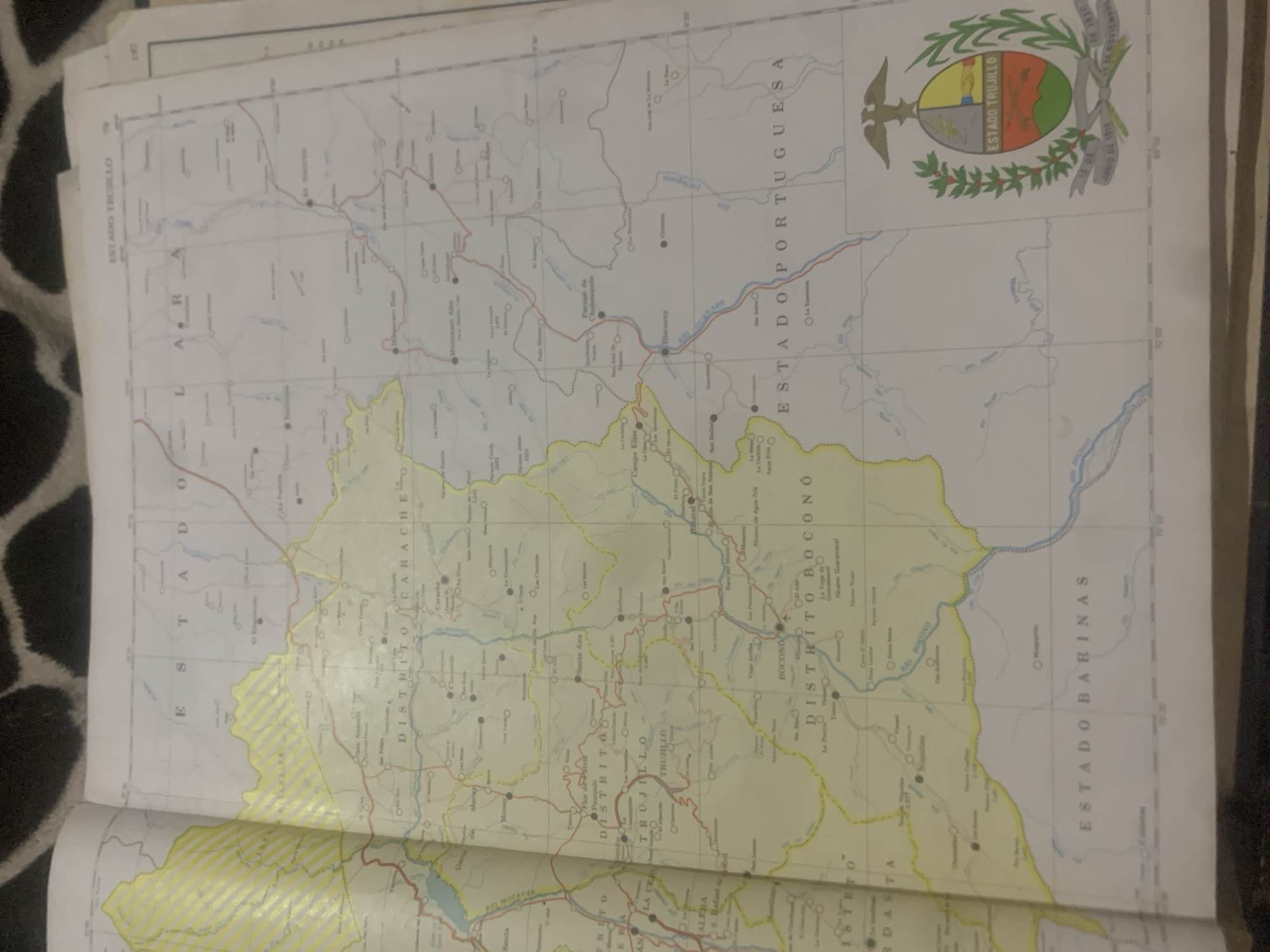
The image is a close-up, overhead shot of a printed map, likely a page from an atlas or a folded map. The map displays geographical regions of Venezuela, with state and district boundaries clearly demarcated. The primary focus of the map is the "ESTADO TRUJILLO." Several districts within Trujillo are labeled, including "DISTRITO CARACHE," "DISTRITO TRUJILLO," and "DISTRITO BOCONÓ." Roads are depicted as thin red and blue lines, and rivers are shown as blue wavy lines. Various towns and cities are marked with circles and labeled with their names, such as "Trujillo," "Bocono," "Carache," and "Valera." The map also includes smaller settlements and geographical features.

In the bottom right corner of the map, the coat of arms for "ESTADO TRUJILLO" is prominently displayed, featuring a shield divided into quadrants with symbols and a laurel wreath. The map is laid out on a surface that appears to be a dark, textured fabric, possibly a carpet or a blanket, with a pattern visible at the top of the image. The lighting suggests an indoor environment, and the overall condition of the map indicates it is a used item, with some creasing and minor imperfections.

The location of La Tagua, Venezuela is not explicitly visible or labeled on this particular portion of the map. The map's scale and the visible labels do not pinpoint this specific town.
bombolico

Jun 25, 2026, 2:28 PM

La Tagua, Venezuela

Stake attention in this memory

curiosity
nostalgia
exploration
planning
adventure

The image is a close-up, overhead shot of a printed map, likely a page from an atlas or a folded map. The map displays geographical regions of Venezuela, with state and district boundaries clearly demarcated. The primary focus of the map is the "ESTADO TRUJILLO." Several districts within Trujillo are labeled, including "DISTRITO CARACHE," "DISTRITO TRUJILLO," and "DISTRITO BOCONÓ." Roads are depicted as thin red and blue lines, and rivers are shown as blue wavy lines. Various towns and cities are marked with circles and labeled with their names, such as "Trujillo," "Bocono," "Carache," and "Valera." The map also includes smaller settlements and geographical features. In the bottom right corner of the map, the coat of arms for "ESTADO TRUJILLO" is prominently displayed, featuring a shield divided into quadrants with symbols and a laurel wreath. The map is laid out on a surface that appears to be a dark, textured fabric, possibly a carpet or a blanket, with a pattern visible at the top of the image. The lighting suggests an indoor environment, and the overall condition of the map indicates it is a used item, with some creasing and minor imperfections. The location of La Tagua, Venezuela is not explicitly visible or labeled on this particular portion of the map. The map's scale and the visible labels do not pinpoint this specific town.

Loading AttnAds…

transactions
revenues
stakers
Earliest
Latest
Highest stake

No transactions found

More from this user

More from La Tagua

bombolico

Jun 25, 2026, 2:28 PM

La Tagua, Venezuela

Licensed under Creative Commons Attribution 4.0 International License. You are free to share and adapt this content with proper attribution.



