
Sign in
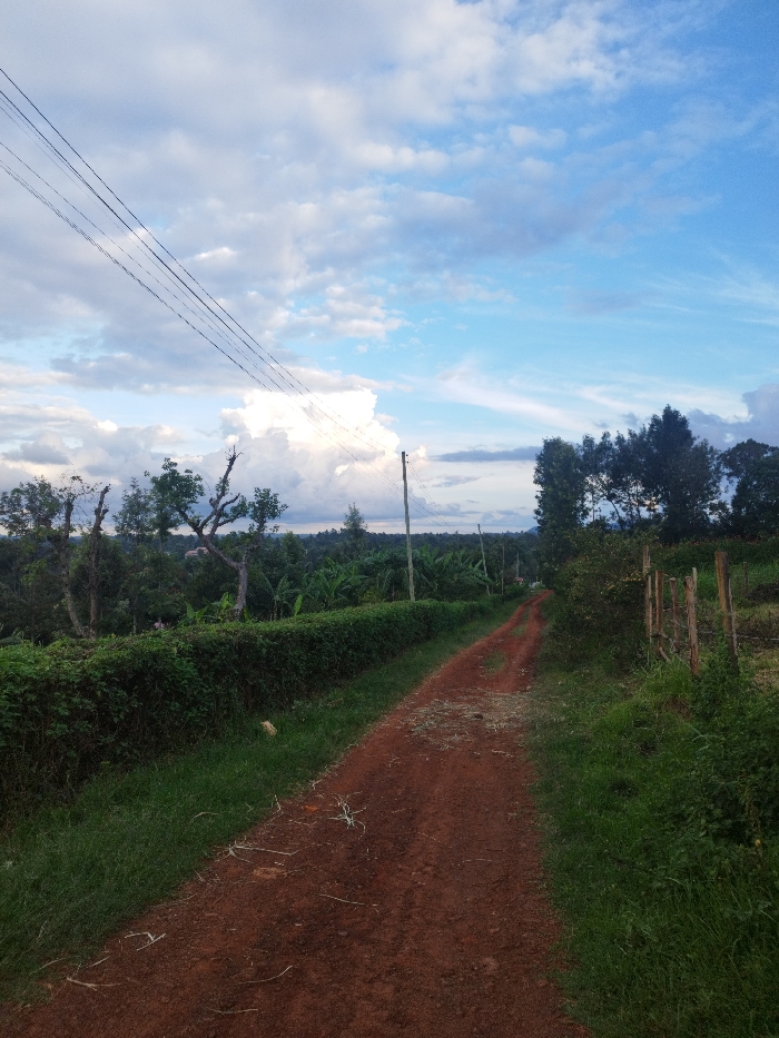
The image shows a dirt road winding through a rural area in Nyeri, Kenya, at coordinates -0.441 latitude, 36.947 longitude. The road is lined with lush green vegetation on both sides, including a dense hedge of bushes and a patch of tall green grass. The road is dusty, with a reddish-brown hue, and a few stray blades of grass and twigs lie scattered on the surface. Two wooden utility poles stand tall along the roadside, with multiple power lines running overhead. In the background, a distant line of trees stretches across the horizon, suggesting a forested area. The sky is a clear blue, with white clouds billowing in the distance. The atmosphere is peaceful and serene, with no people or animals visible in the scene.
Kanjes

Apr 30, 2025, 2:55 PM

Nyeri, Kenya

Stake attention in this memory

tranquil
peaceful
serene
rural
hopeful

The image shows a dirt road winding through a rural area in Nyeri, Kenya, at coordinates -0.441 latitude, 36.947 longitude. The road is lined with lush green vegetation on both sides, including a dense hedge of bushes and a patch of tall green grass. The road is dusty, with a reddish-brown hue, and a few stray blades of grass and twigs lie scattered on the surface. Two wooden utility poles stand tall along the roadside, with multiple power lines running overhead. In the background, a distant line of trees stretches across the horizon, suggesting a forested area. The sky is a clear blue, with white clouds billowing in the distance. The atmosphere is peaceful and serene, with no people or animals visible in the scene.

Loading AttnAds…

transactions
revenues
stakers
Earliest
Latest
Highest stake

No transactions found

More from this user

More from Nyeri

Kanjes

Apr 30, 2025, 2:55 PM

Nyeri, Kenya

Licensed under Creative Commons Attribution 4.0 International License. You are free to share and adapt this content with proper attribution.