
Sign in
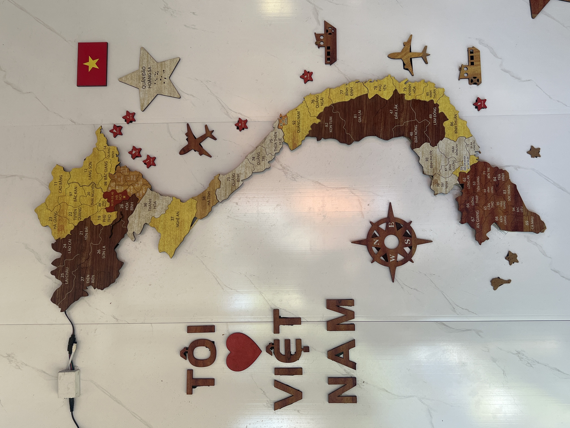
This image displays a patriotic wall decoration featuring a multi-piece wooden map of Vietnam. The map is rendered in varying shades of brown wood, with individual provinces delineated and labeled with names and numerical codes. It is affixed to a white wall with subtle grey marble-like veining, which appears to be composed of two vertical panels.

To the left of the map, dark brown wooden letters spell out "TÔI VIỆT NAM," with a red heart shape replacing the word "YÊU" (love), completing the phrase "I love Vietnam." Below this text and to the left of the central map section, a wooden compass rose is mounted.

Above and to the right of the northern part of the map, a small wooden depiction of the red Vietnamese flag with a yellow star is present. Below the flag, a star-shaped wooden cutout is labeled "QUẦN ĐẢO HOÀNG SA" (Paracel Islands).

Several small, red star-shaped markers, some with white text indicating specific locations, are distributed around the map. Additionally, multiple wooden cutouts of airplanes and boats are placed in various positions surrounding the map, suggesting national assets or regional transport.

In the upper left corner, a small white electronic control box with black wires connected to the wall and extending towards the map is visible, potentially for backlighting or an interactive element. No people are present in the scene. The map includes the province of Khanh Hoa (labeled 85), indicating the location of Nha Trang. This display is observed within a city environment in Nha Trang, Vietnam.
burn in hell

Mar 23, 2026, 9:36 AM

Nha Trang, Vietnam

Stake attention in this memory

Patriotism
Nostalgia
Wanderlust
Pride
Curiosity

This image displays a patriotic wall decoration featuring a multi-piece wooden map of Vietnam. The map is rendered in varying shades of brown wood, with individual provinces delineated and labeled with names and numerical codes. It is affixed to a white wall with subtle grey marble-like veining, which appears to be composed of two vertical panels. To the left of the map, dark brown wooden letters spell out "TÔI VIỆT NAM," with a red heart shape replacing the word "YÊU" (love), completing the phrase "I love Vietnam." Below this text and to the left of the central map section, a wooden compass rose is mounted. Above and to the right of the northern part of the map, a small wooden depiction of the red Vietnamese flag with a yellow star is present. Below the flag, a star-shaped wooden cutout is labeled "QUẦN ĐẢO HOÀNG SA" (Paracel Islands). Several small, red star-shaped markers, some with white text indicating specific locations, are distributed around the map. Additionally, multiple wooden cutouts of airplanes and boats are placed in various positions surrounding the map, suggesting national assets or regional transport. In the upper left corner, a small white electronic control box with black wires connected to the wall and extending towards the map is visible, potentially for backlighting or an interactive element. No people are present in the scene. The map includes the province of Khanh Hoa (labeled 85), indicating the location of Nha Trang. This display is observed within a city environment in Nha Trang, Vietnam.

Loading AttnAds…

transactions
revenues
stakers
Earliest
Latest
Highest stake

No transactions found

More from this user

More from Nha Trang

burn in hell

Mar 23, 2026, 9:36 AM

Nha Trang, Vietnam

Licensed under Creative Commons Attribution 4.0 International License. You are free to share and adapt this content with proper attribution.