Stake attention in this memory
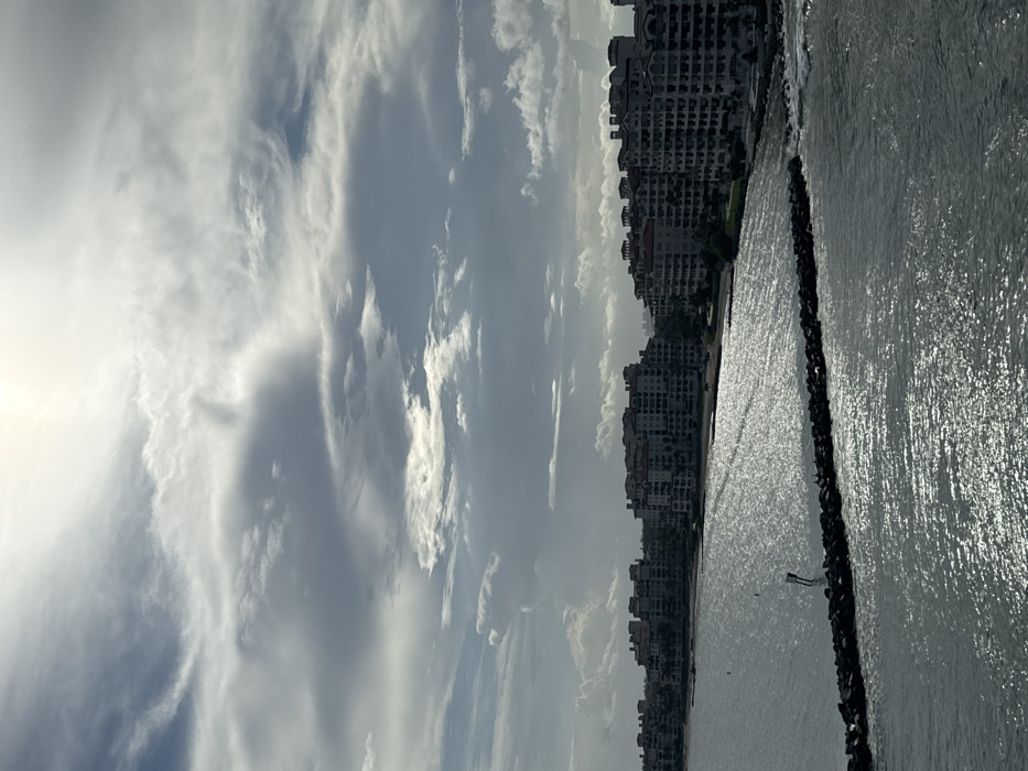
The image displays a coastal panorama identified as the waterfront of Fisher Island, Miami-Dade County, viewed from the Government Cut channel in Miami Beach, United States. The upper half of the frame is occupied by a partly cloudy sky, featuring a bright, diffused light source, presumably the sun, in the upper-right quadrant. The lower half depicts a body of water with extensive surface glare and shimmering reflections. Along the horizon, a continuous line of multi-story residential buildings, characteristic of condominiums on Fisher Island, are visible. These structures feature light-colored exteriors and dark, possibly terracotta-tiled roofs, appearing partially shadowed against the water and sky. A prominent dark, rocky breakwater extends horizontally into the water from the right mid-ground, showing wave interaction on its seaward side. A single white and black navigational marker stands vertically in the water near the breakwater. No people are discernible in the scene. The overall environment suggests a sunny, yet partly overcast day.
No transactions found