Stake attention in this memory
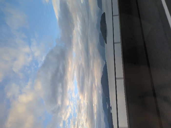
The image displays a panoramic view of Howe Sound, observed from an elevated position, likely the Sea to Sky Highway (Highway 99) near Horseshoe Bay in West Vancouver, Canada. The foreground features a dark grey concrete highway barrier, approximately one-third of the frame's height from the bottom, with a horizontal metal railing running just above it. Below the barrier, a dark asphalt road surface is visible, showing a white lane marker on the right edge. No individuals, vehicles, or discernible actions are present in the foreground. The midground is dominated by the calm, grey-toned waters of Howe Sound, reflecting the overcast sky. Several dark, forested islands and peninsulas rise from the water, with one distinct, rounded island prominently positioned towards the mid-right. Behind these immediate landforms, multiple layers of larger, hazy, dark green and grey mountains recede into the distance. The background consists of a partially clouded sky, with patches of bright blue sky interspersed among various formations of grey and white stratocumulus clouds. The lighting is diffused, suggesting either early morning or late afternoon under overcast conditions.
No transactions found