Stake attention in this memory
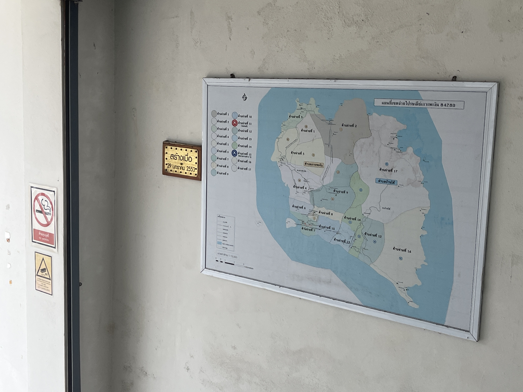
A framed map of a geographical area, along with a brass plaque and two smaller signs, are displayed on a textured, light-colored wall. The wall appears to be concrete or stucco, showing some wear and discoloration. To the far left, a dark vertical door frame or structural element is visible. The central object is a large, rectangular map in a white frame, depicting an island divided into multiple numbered regions. The title of the map, clearly visible at the top right, reads "แผนที่เขตจ่ายไปรษณีย์เกาะพะงัน 84280" (Map of Koh Phangan Post Office delivery area 84280). A legend on the left side of the map lists "ด้านจ่ายที่" (Delivery Area No.) from 1 to 17, with some areas specifically marked on the map itself, such as "ตำบลเกาะพะงัน" (Koh Phangan Subdistrict) and "ตำบลบ้านใต้" (Ban Tai Subdistrict). The map's scale is indicated as "มาตราส่วน 1:19,000" (Scale 1:19,000). Below the map and to its left, a small, ornate brass plaque is mounted. The text on the plaque reads "สร้างเมื่อ" (Created on) followed by the date "29 มกราคม 2553" (29 January 2553 BE, which corresponds to 2010 AD). Further to the left, two smaller signs are partially visible on the wall. The upper sign is a red and white "NO SMOKING" symbol with Thai text "ห้ามสูบบุหรี่" and English "NO SMOKING". Below it, a yellow triangular sign with an eye symbol indicates "CCTV SURVEILLANCE". The lighting suggests it is daytime. The scene is likely within or near a post office or public building on Koh Phangan, Thailand.
No transactions found