Sign in
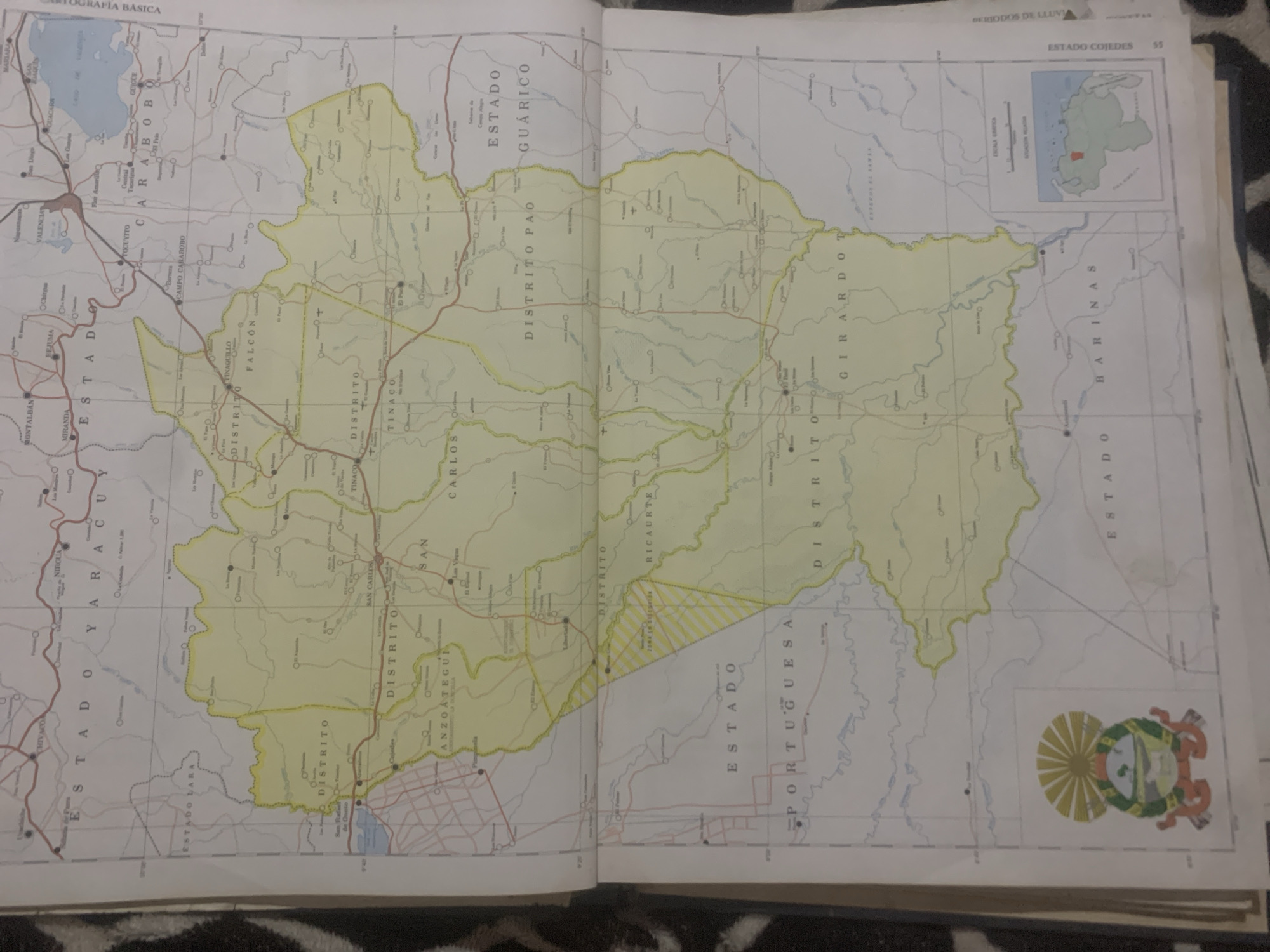
The image displays a page from a geographical atlas or map book, featuring a detailed map of a region in Venezuela. The map is predominantly yellow, with thin black lines indicating roads and bodies of water, and thicker black lines outlining administrative boundaries. Several place names are visible in bold, capital letters, suggesting districts and states.

The primary subject is the map itself, with visible text labels such as "CARTOGRAFÍA BÁSICA," "ESTADO COJEDES," "ESTADO GUÁRICO," "ESTADO FALCÓN," "ESTADO YARACUY," "ESTADO LARA," "ESTADO BARINAS," and "ESTADO PORTUGUESA." There are also smaller labels for districts within these states, like "DISTRITO PAO," "DISTRITO GIRARDO," "DISTRITO RICARTE," "DISTRITO TINACQ," and "DISTRITO ANZOATEGUÍ."

A small inset map in the upper right corner shows the location of the mapped region within Venezuela. A coat of arms is depicted in the lower right corner. The overall scene is that of an open book or atlas, lying flat, likely in a setting where a map is being consulted. There are no people or active events depicted on the map itself. The lighting suggests an indoor environment. The map's detail and the presence of administrative labels indicate a focus on geography, politics, and infrastructure of the region.
bombolico

Jun 25, 2026, 2:22 PM

La Tagua, Venezuela

Short Term

Stake attention in this memory

informative
detailed
geographical
historical
educational

The image displays a page from a geographical atlas or map book, featuring a detailed map of a region in Venezuela. The map is predominantly yellow, with thin black lines indicating roads and bodies of water, and thicker black lines outlining administrative boundaries. Several place names are visible in bold, capital letters, suggesting districts and states. The primary subject is the map itself, with visible text labels such as "CARTOGRAFÍA BÁSICA," "ESTADO COJEDES," "ESTADO GUÁRICO," "ESTADO FALCÓN," "ESTADO YARACUY," "ESTADO LARA," "ESTADO BARINAS," and "ESTADO PORTUGUESA." There are also smaller labels for districts within these states, like "DISTRITO PAO," "DISTRITO GIRARDO," "DISTRITO RICARTE," "DISTRITO TINACQ," and "DISTRITO ANZOATEGUÍ." A small inset map in the upper right corner shows the location of the mapped region within Venezuela. A coat of arms is depicted in the lower right corner. The overall scene is that of an open book or atlas, lying flat, likely in a setting where a map is being consulted. There are no people or active events depicted on the map itself. The lighting suggests an indoor environment. The map's detail and the presence of administrative labels indicate a focus on geography, politics, and infrastructure of the region.

Symbol

3EE63

Volume

11,550

Creator

+$0.08

Revenue

+$0.10

TVL

$7.25

1D
1W
1M
All

Loading AttnAds…

transactions
revenues
stakers
Earliest
Latest
Highest stake

1

Katy

Staked 11d ago

$7.22 USD

+$0.03 USD

+0.4%

2

Rev Bot 🤖💰

Injected revenue 11d ago

Revenue bonus for the last stake.

+$0.12 USD

More from this user

More from La Tagua

bombolico

Jun 25, 2026, 2:22 PM

La Tagua, Venezuela

Licensed under Creative Commons Attribution 4.0 International License. You are free to share and adapt this content with proper attribution.





