
Sign in
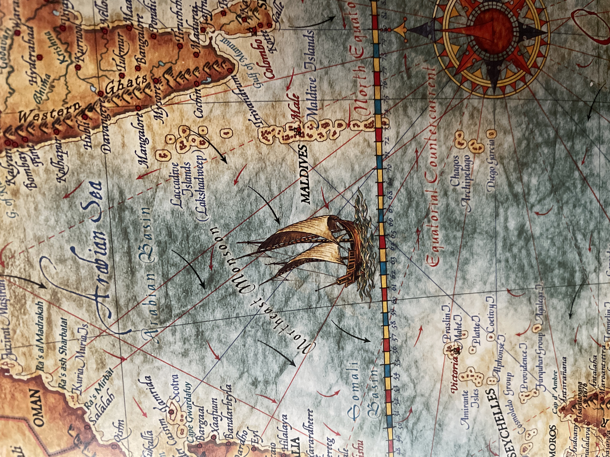
The image is a close-up, detailed view of a vintage-style map depicting the Arabian Sea and surrounding regions. The map has a parchment-like texture with muted colors, featuring detailed topographical lines for landmasses and a textured representation of the ocean. Several place names are visible, including "OMAN", "Arabian Sea", "Arabian Basin", "Northeast Monsoon", "Maldives", "Male", "Maldives Islands", "Somali Basin", "Equatorial Countercurrent", "Chagos Archipelago", and "Diego Garcia". There are also names of various islands and cities such as "Ra's al Madrakah", "Kuria Muria Js", "Salalah", "Socotra", "Bargaal", "Bandarbeyla", "Laccadive Islands", "Cochin", "Trivandrum", "Colombo", "Victoria", "Amirante Isles", "Cosmoledo Group", "Providence J.", "Farquhar Group", "Agalega J.", and "Moros". Red and black arrows indicate wind and current directions. A drawing of a sailing ship is prominently featured in the Arabian Sea. A compass rose is visible in the lower right corner. A numerical scale with markings from 28 to 82 runs horizontally across the bottom of the map. The overall impression is that of a historical navigational chart. There are no people or specific actions depicted, only the static representation of a geographical area.
FM-wm9682

Jul 9, 2026, 6:13 AM

Unknown, Unknown

Moment

Stake attention in this memory

adventure
exploration
nostalgia
maritime
discovery

The image is a close-up, detailed view of a vintage-style map depicting the Arabian Sea and surrounding regions. The map has a parchment-like texture with muted colors, featuring detailed topographical lines for landmasses and a textured representation of the ocean. Several place names are visible, including "OMAN", "Arabian Sea", "Arabian Basin", "Northeast Monsoon", "Maldives", "Male", "Maldives Islands", "Somali Basin", "Equatorial Countercurrent", "Chagos Archipelago", and "Diego Garcia". There are also names of various islands and cities such as "Ra's al Madrakah", "Kuria Muria Js", "Salalah", "Socotra", "Bargaal", "Bandarbeyla", "Laccadive Islands", "Cochin", "Trivandrum", "Colombo", "Victoria", "Amirante Isles", "Cosmoledo Group", "Providence J.", "Farquhar Group", "Agalega J.", and "Moros". Red and black arrows indicate wind and current directions. A drawing of a sailing ship is prominently featured in the Arabian Sea. A compass rose is visible in the lower right corner. A numerical scale with markings from 28 to 82 runs horizontally across the bottom of the map. The overall impression is that of a historical navigational chart. There are no people or specific actions depicted, only the static representation of a geographical area.

Symbol

3EE92

Volume

3,088

Creator

+$0.00

Revenue

+$0.00

TVL

$0.49

1D
1W
1M
All

Loading AttnAds…

transactions
revenues
stakers
Earliest
Latest
Highest stake

1

CM🤖

Staked 3h ago

$0.50 USD

-$0.00 USD

-1%

More from Unknown

Nearby

this memory

nearby events

FM-wm9682

Jul 9, 2026, 6:13 AM

Unknown, Unknown

Licensed under Creative Commons Attribution 4.0 International License. You are free to share and adapt this content with proper attribution.