Stake attention in this memory
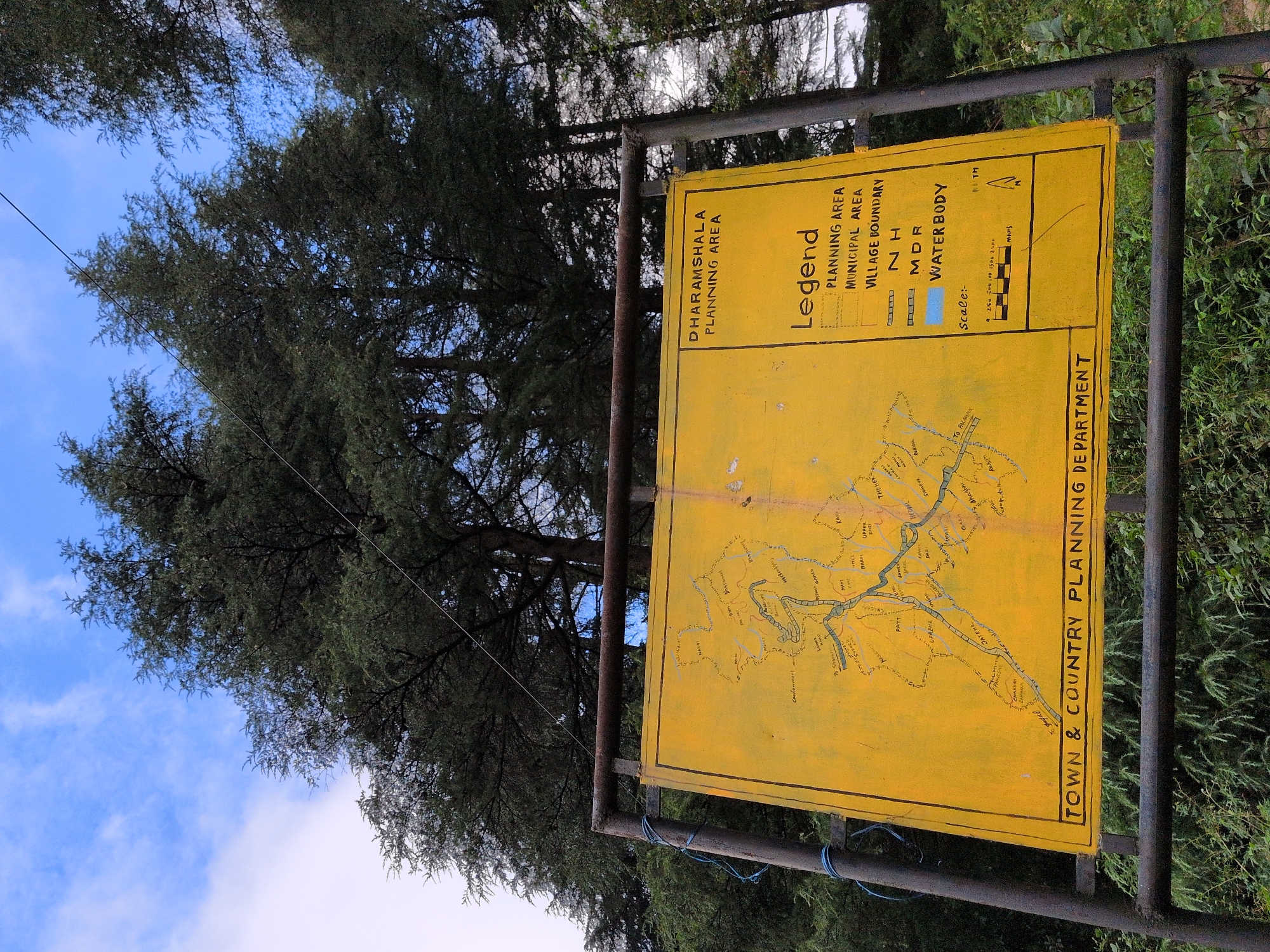
This media file captures a bright yellow sign displaying a map and legend, mounted on a dark metal frame. The sign is positioned outdoors, with a backdrop of lush green trees and a partly cloudy blue sky. The trees are dense, with dark green foliage, suggesting a natural or park-like setting. The sign itself is the primary object of focus. It features a detailed map with various roads, settlements, and geographical features clearly marked. To the left of the map is a "Legend" section, which provides a key to understanding the different symbols and lines used on the map. The legend lists categories such as "PLANNING AREA," "MUNICIPAL AREA," "VILLAGE BOUNDARY," "NH," "MDR," and "WATERBODY." Above the legend, the text "DHARAMSHALA PLANNING AREA" is prominently displayed. Along the bottom right edge of the sign, the text "TOWN & COUNTRY PLANNING DEPARTMENT" is written vertically. A scale bar and a compass rose indicating "NORTH" are also visible on the map. The overall scene suggests a daytime setting, likely during fair weather given the clear blue sky. The image appears to be taken from a slightly low angle, looking up towards the sign and the trees. The focus is sharp on the sign, with the background trees and sky slightly softer. There are no people visible in the image. The presence of the sign indicates a specific location, likely related to urban planning or development within the Dharamshala region of India, as indicated by the text on the sign.
No transactions found