
Stake attention in this memory
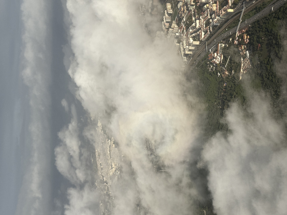
This image presents an aerial view of Lisbon, Portugal, looking down through and above a significant layer of clouds. The central-left portion of the frame is dominated by Monsanto Forest Park, an expanse of dense green canopy. To the right of the park, a major transportation corridor is visible, comprising a multi-lane highway (identified as the Eixo Norte-Sul / IC17) running parallel to a railway line (Linha de Cintura). This corridor defines the boundary between the forest and the urban development of Lisbon's eastern neighborhoods, such as Campolide or São Domingos de Benfica, which are densely packed with residential and commercial buildings. Traffic is discernable on the highway as small dark shapes. Further into the distance in the upper-left, more urban areas are visible through breaks in the heavy cloud cover. A prominent atmospheric optical phenomenon, identified as a cloudbow or fogbow (a glory), manifests as a faint, iridescent circular halo within the clouds in the mid-left area, interacting with sunlight. The sky above is heavily overcast with dark grey cloud formations.
Loading AttnAds…
No transactions found