Sign in
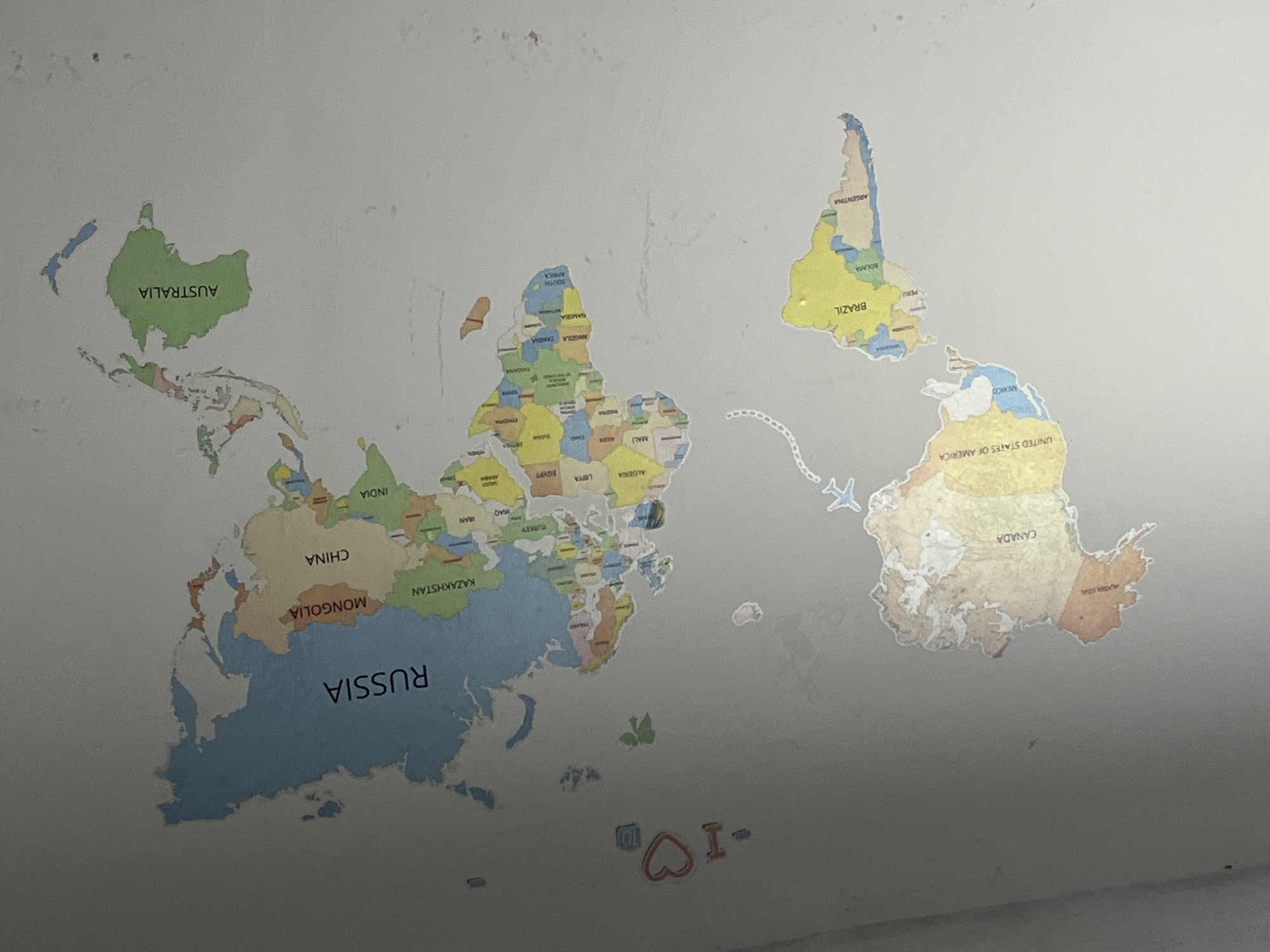
An indoor, eye-level shot captures a large, colorful world map decal applied to a light-colored wall. The map is notably oriented upside down, with the southern hemisphere at the top and the northern hemisphere at the bottom.

The decal shows various countries rendered in different colors, creating a vibrant, educational display. Several parts of the map show signs of wear, with edges peeling or areas appearing faded and creased, particularly noticeable around North America and scattered across the wall itself. A small, stylized paper airplane graphic is positioned to the right of Africa, suggesting a flight path across the ocean. Below the landmasses, small decorative elements are visible: a white "10" within a square, a red heart, and a letter "I" and a dash, possibly forming "I <3" or "I love".

Visible text on the map, all inverted due to the map's orientation, includes: AUSTRALIA, CHINA, INDIA, RUSSIA, MONGOLIA, KAZAKHSTAN, IRAN, IRAQ, TURKEY, EGYPT, LIBYA, ALGERIA, CHAD, MALI, NIGERIA, ETHIOPIA, TANZANIA, ANGOLA, ZAMBIA, NAMIBIA, SOUTH AFRICA, BRAZIL, BOLIVIA, PERU, ARGENTINA, MEXICO, UNITED STATES OF AMERICA, CANADA, and ALASKA.

The wall itself is a uniform, light grey or off-white color, with some subtle smudges and imperfections visible. The lighting is somewhat uneven, creating a slight shadow or darker area towards the bottom right of the image. The scene suggests a child's room or an informal educational setting in Jiangjin, China.
Meyde❤️

Apr 21, 2026, 3:23 PM

Jiangjin, China

Moment

Stake attention in this memory

curiosity
wonder
adventure
education
inspiration

An indoor, eye-level shot captures a large, colorful world map decal applied to a light-colored wall. The map is notably oriented upside down, with the southern hemisphere at the top and the northern hemisphere at the bottom. The decal shows various countries rendered in different colors, creating a vibrant, educational display. Several parts of the map show signs of wear, with edges peeling or areas appearing faded and creased, particularly noticeable around North America and scattered across the wall itself. A small, stylized paper airplane graphic is positioned to the right of Africa, suggesting a flight path across the ocean. Below the landmasses, small decorative elements are visible: a white "10" within a square, a red heart, and a letter "I" and a dash, possibly forming "I <3" or "I love". Visible text on the map, all inverted due to the map's orientation, includes: AUSTRALIA, CHINA, INDIA, RUSSIA, MONGOLIA, KAZAKHSTAN, IRAN, IRAQ, TURKEY, EGYPT, LIBYA, ALGERIA, CHAD, MALI, NIGERIA, ETHIOPIA, TANZANIA, ANGOLA, ZAMBIA, NAMIBIA, SOUTH AFRICA, BRAZIL, BOLIVIA, PERU, ARGENTINA, MEXICO, UNITED STATES OF AMERICA, CANADA, and ALASKA. The wall itself is a uniform, light grey or off-white color, with some subtle smudges and imperfections visible. The lighting is somewhat uneven, creating a slight shadow or darker area towards the bottom right of the image. The scene suggests a child's room or an informal educational setting in Jiangjin, China.

Loading AttnAds…

transactions
revenues
stakers
Earliest
Latest
Highest stake

No transactions found

More from this user

More from Jiangjin

Meyde❤️

Apr 21, 2026, 3:23 PM

Jiangjin, China

Licensed under Creative Commons Attribution 4.0 International License. You are free to share and adapt this content with proper attribution.