Stake attention in this memory
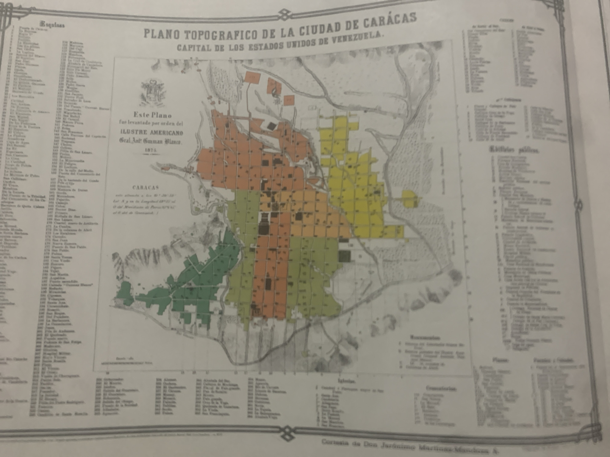
This is a scanned image of an antique topographical map of Caracas, Venezuela, titled "PLANO TOPOGRAFICO DE LA CIUDAD DE CARACAS CAPITAL DE LOS ESTADOS UNIDOS DE VENEZUELA." The map is dated 1873 and was created by order of the "ILUSTRE AMERICANO Gral. Ant. Emman Blanco." The map depicts the city with various areas color-coded in orange, yellow, and green, likely representing different districts or land uses. To the left of the map is a list of "Esquinas" (Corners) with numbered entries, followed by other categorized lists such as "Edificios públicos" (Public Buildings), "Recesiones" (Recessions), "Conserfacion" (Conservation), "Iglesias" (Churches), and "Plazas" (Squares). These lists are in Spanish and provide further details about the city's layout and landmarks. The map itself shows a detailed representation of the urban landscape, with streets, buildings, and natural features like rivers and hills. The overall impression is of a historical document providing a snapshot of Caracas in the late 19th century. The image appears to be of a printed document, possibly from a book or archive, with some visible aging and creasing. The bottom right corner of the image contains text that appears to be a credit line: "Cortesia de Don Jarosimo Martins Man."
Symbol
43BBB
Volume
3,307
Creator
+$0.07
Revenue
+$0.04
TVL
$1.13