Stake attention in this memory
Earth
Atmosphere
Mountains
Space
View from Space
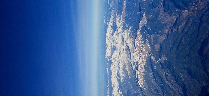
An aerial view captures Earth's curvature, transitioning from the deep blue expanse of the atmosphere into a visible lighter band representing the upper layers. Adjoining this atmospheric boundary is rugged, mountainous terrain. Patches of snow cover higher elevations, contrasting with darker, vegetated areas below. The terrain exhibits a varied texture of ridges, valleys, and winding drainage patterns. The image presents a stark boundary between the sky and Earth's surface.
Symbol
445CE
Volume
14,661
Creator
+$0.18
Revenue
+$0.00
TVL
$17.53
1D
1W
1M
All
transactions
revenues
stakers