Stake attention in this memory
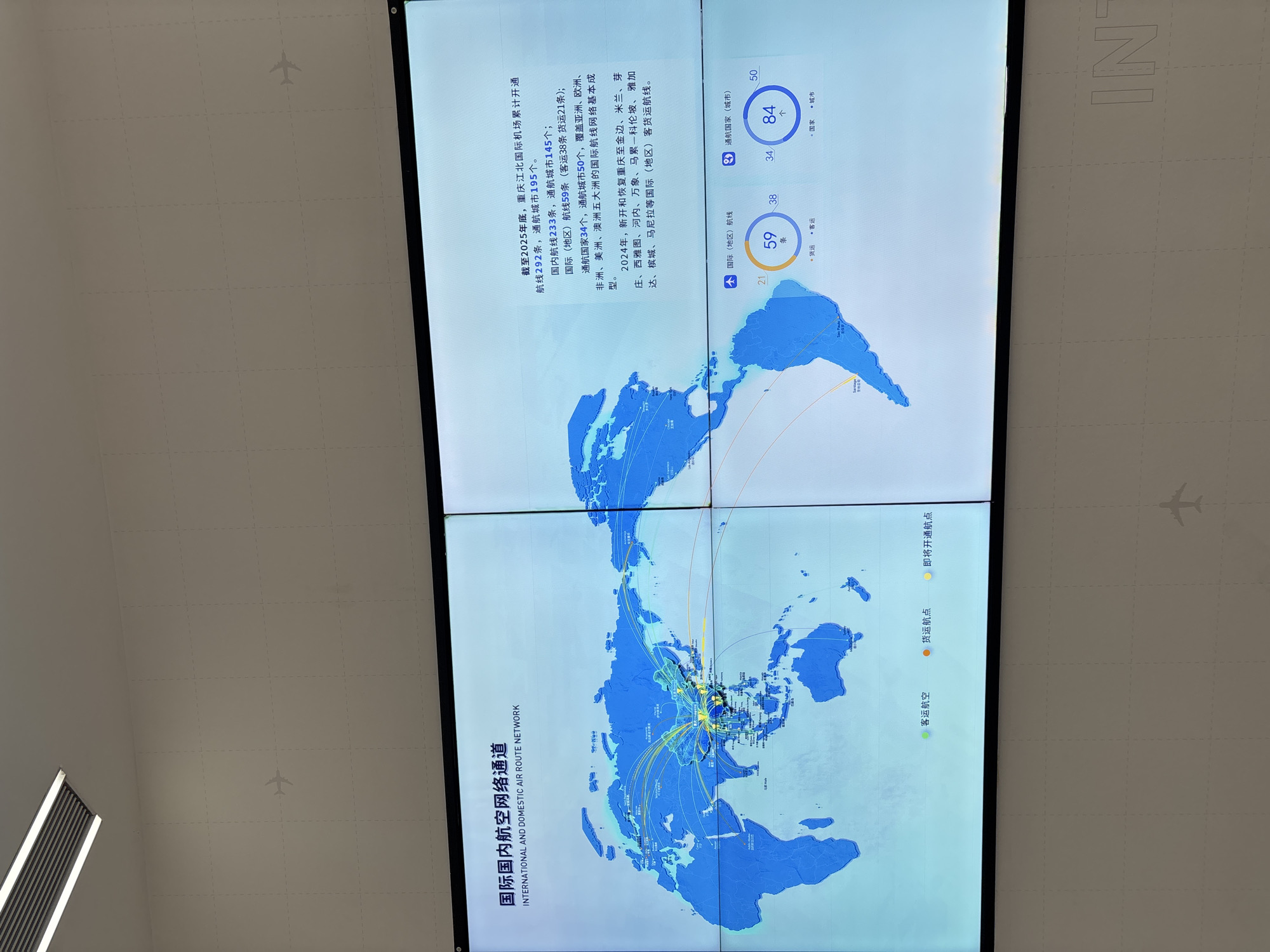
The image displays a large digital map showing international and domestic air routes. The map is centered on Asia, with lines extending to Europe, Africa, the Americas, and Australia. Various cities are marked on the map with connecting lines representing flight paths. Below the map, there is text providing statistics and future projections for air routes. To the left of the map, there is a legend indicating "Passenger Airlines" (green dots), "Cargo Hubs" (orange dots), and "Routes to be Opened" (yellow dots). To the right of the map, there are statistics presented in a circular graph format, showing "International (Regions/Countries) Routes" and "Domestic (Countries) Routes." The text indicates that the map is related to the city of Shapingba District, China, and specifically mentions Chongqing Jiangbei International Airport. The scene appears to be an exhibition or presentation within a modern building, likely a conference center or airport information display, given the large screen and minimalist background. There are no people clearly visible in the image.
No transactions found

