Stake attention in this memory
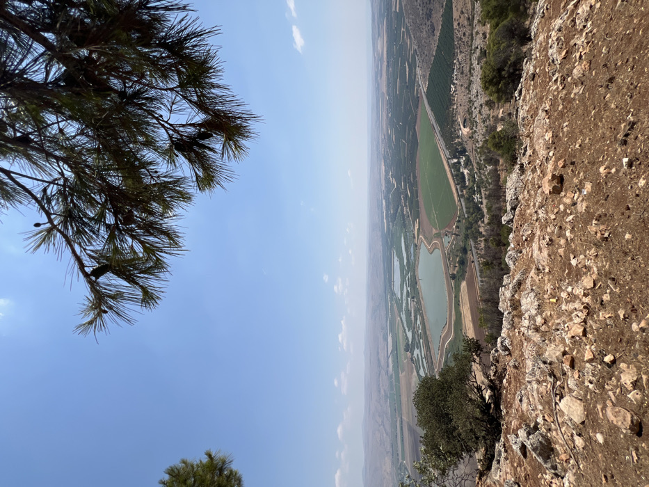
A high-angle landscape view depicts the Hula Valley within the Mevoot HaHermon Regional Council, Israel, under a bright, clear blue sky with minimal cloud cover. The immediate foreground is a rocky, reddish-brown slope with scattered small vegetation and pine tree branches overhanging from the upper right and left. The midground presents an expansive valley floor characterized by several light-green to teal-colored, geometrically shaped water bodies (likely fish ponds) surrounded by rectangular agricultural fields of varying cultivation stages and hues of green and brown. A linear infrastructure, consistent with a road, runs through the valley. Distant, muted brown hills define the horizon. No individuals or active actions are present.
Loading AttnAds…
No transactions found