Stake attention in this memory
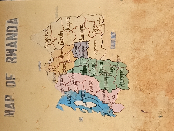
The media file presents a vertically oriented, hand-painted map of Rwanda, displayed on a textured, light brown surface, likely a wall or a sturdy board, located in Rukira, Rwanda. The central subject is the map of Rwanda, illustrating its internal administrative divisions, which are colored in various pastel shades including brown, green, pink, orange, purple, and blue for water bodies. No people or specific activities are shown. Notable details include the prominent title "MAP OF RWANDA" in dark, stenciled letters at the top left. The map outlines Rwanda's borders with neighboring countries, explicitly labeling "UGANDA" to the north, "TANZANIA" to the east, "BURUNDI" to the southeast, and "DRC" (Democratic Republic of Congo) to the west. "LAKE KIVU" is clearly marked in blue along the western border. Many of Rwanda's districts are identified by name, including Nyagatare, Kayonza, Gatsibo, Gicumbi, Rulindo, Musanze, Burera, Gakenke, Rwamagana, Gasabo, Ngororero, Muhanga, Ruhango, Nyanza, Karongi, Rutsiro, Rubavu, Nyamasheke, Huye, Nyamagabe, Gisagara, Nyaruguru, Rusizi, Bugesera, and Kirehe. The map has a rustic, hand-drawn aesthetic, suggesting it serves as a local informational or educational display.
No transactions found