
Stake attention in this memory
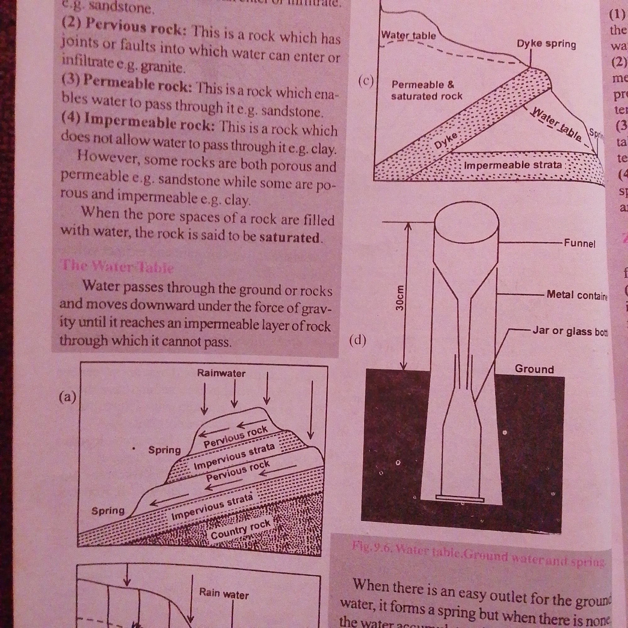
The image displays text and diagrams related to geology and hydrology. On the left, there is a list of rock types (pervious, permeable, impermeable) with descriptions. Below this is a heading "The Water Table" and a paragraph explaining how water moves through the ground. At the bottom left, diagram (a) illustrates rainwater infiltrating through pervious rock layers and impervious strata, leading to springs. On the right, diagram (c) shows a cross-section of the ground with a "water table," "dyke spring," and "permeable & saturated rock" above "impermeable strata." Diagram (d) is a schematic of an experimental setup for measuring something over a 30cm height, involving a funnel, a metal container, and a jar or glass bottle, placed on the "Ground." The text below diagram (d) mentions "Fig. 9.6. Water table, Ground water and spring" and discusses how ground water forms a spring when there is an easy outlet. There is no information in this image that relates to the city of Jalingo, Nigeria, or any specific urban environment. The content is purely educational and diagrammatic.
Symbol
494DC
Volume
3,273
Creator
+$0.00
Revenue
+$0.01
TVL
$0.26
Loading AttnAds…

2

Rev Bot 🤖💰
Injected revenue 1mo ago
“Revenue bonus for the last stake.”
+$0.01 USD