Stake attention in this memory
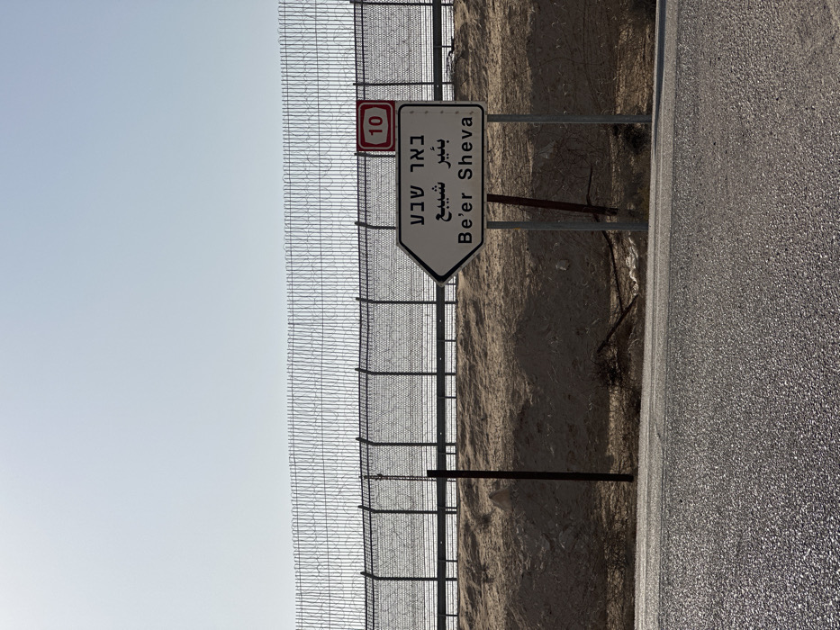
The image depicts an arid, desert landscape under a clear, bright sky. A tall security fence, constructed from chain-link mesh and topped with multiple strands of coiled razor wire, extends horizontally across the middle ground. Behind the fence, a raised, light brown sandy embankment is visible, partially obscuring a track or road. In front of the fence, a similar sandy slope descends towards a paved asphalt road that occupies the lower third of the frame. A white, arrow-shaped directional sign is positioned in the lower right-midground, pointing left. The sign bears the destination "Be'er Sheva" written in Hebrew (באר שבע), Arabic (بئير شيبع), and English. Above this sign and affixed to a fence post is a smaller red rectangular sign with a white border, displaying the number "10" in white, indicating Route 10. Several metal posts support the signage and are visible along the roadside and fence line. The environment is devoid of people or discernible activity. The scene is located within the Ramat Negev Regional Council, Israel, specifically along Route 10 in the Negev Desert, near the border with Egypt, as indicated by the "Be'er Sheva" sign and the prominent Route 10 marker.
Symbol
4AA8C
Volume
2,195
Creator
+$0.00
Revenue
+$0.00
TVL
$0.43