Sign in
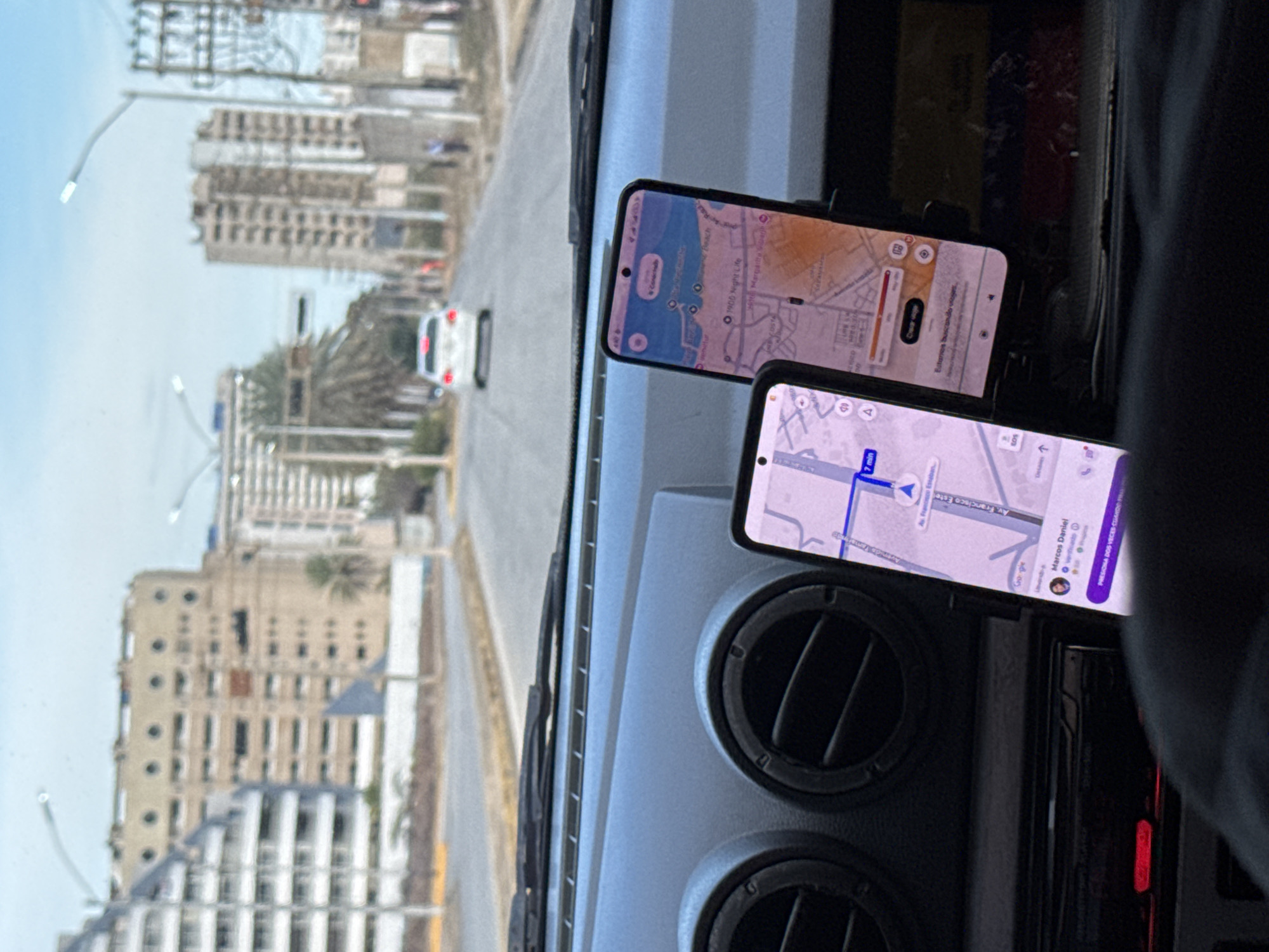
The image captures a view from inside a vehicle, looking out through the windshield onto a street scene. Two smartphones are prominently displayed, mounted on the car's dashboard and both showing navigation applications.

On the top smartphone, a map displays coastal features, with markers for "Beach" and "1900 Night Life". Text partially visible includes "Esturies buscando vrages" (likely "Estás buscando viajes" - You are looking for rides) and possibly "Playa Margarita" (Margarita Beach), suggesting a ride-sharing or travel-related app. The map's branding is partially visible as "Cro gie", hinting at Google Maps.

The bottom smartphone also shows a map with a blue route highlighted, indicating "Av. Francisco Este" and an estimated travel time of "7 min". A user profile named "Marcos Daniel" is visible, along with an instruction "PRESIONA DOS VECES CAND" (Press twice when...).

Outside the vehicle, a multi-lane road stretches into the distance, with a white car visible further down the street. Buildings, including multi-story structures and what appear to be apartment complexes, line both sides of the road. Palm trees are scattered among the buildings. The sky is bright and clear, indicating it is daytime. The interior of the car shows air vents and part of the center console.

The scene depicts a moment of travel in what appears to be an urban or coastal area, consistent with the provided location context of Porlamar, Venezuela. The multiple navigation apps suggest the driver may be actively using them for directions or ride-sharing services.
marcosdanielfi

Apr 24, 2026, 8:47 PM

Porlamar, Venezuela

Moment

Stake attention in this memory

anticipation
navigation
journey
urban
technology

The image captures a view from inside a vehicle, looking out through the windshield onto a street scene. Two smartphones are prominently displayed, mounted on the car's dashboard and both showing navigation applications. On the top smartphone, a map displays coastal features, with markers for "Beach" and "1900 Night Life". Text partially visible includes "Esturies buscando vrages" (likely "Estás buscando viajes" - You are looking for rides) and possibly "Playa Margarita" (Margarita Beach), suggesting a ride-sharing or travel-related app. The map's branding is partially visible as "Cro gie", hinting at Google Maps. The bottom smartphone also shows a map with a blue route highlighted, indicating "Av. Francisco Este" and an estimated travel time of "7 min". A user profile named "Marcos Daniel" is visible, along with an instruction "PRESIONA DOS VECES CAND" (Press twice when...). Outside the vehicle, a multi-lane road stretches into the distance, with a white car visible further down the street. Buildings, including multi-story structures and what appear to be apartment complexes, line both sides of the road. Palm trees are scattered among the buildings. The sky is bright and clear, indicating it is daytime. The interior of the car shows air vents and part of the center console. The scene depicts a moment of travel in what appears to be an urban or coastal area, consistent with the provided location context of Porlamar, Venezuela. The multiple navigation apps suggest the driver may be actively using them for directions or ride-sharing services.

Loading AttnAds…

transactions
revenues
stakers
Earliest
Latest
Highest stake

No transactions found

More from this user

More from Porlamar

marcosdanielfi

Apr 24, 2026, 8:47 PM

Porlamar, Venezuela

Licensed under Creative Commons Attribution 4.0 International License. You are free to share and adapt this content with proper attribution.