
Sign in
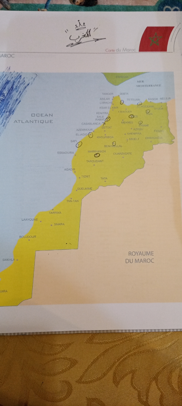
A close-up, slightly angled shot captures a detailed map of Morocco, presented on a light-colored paper and resting on a golden, textured fabric surface, possibly a tablecloth. The map prominently displays the country's geographical features and major cities. The Atlantic Ocean ("OCEAN ATLANTIQUE") is visible to the west, and the Mediterranean Sea ("MER MEDITERRANEE") and part of Spain ("ESPAGNE") to the north.

The landmass of Morocco is depicted in yellow, including the Western Sahara territory, which is shown as an integral part of the country. Numerous cities are labeled, including Tangier, Casablanca, Rabat, Marrakech, Agadir, Laayoune, Dakhla, and many others, some of which are circled in a dark marker, and one near Rabat is marked with an 'X'. These annotations suggest recent interaction with the map, possibly for planning or study.

Above the map, in the top margin, there is elegant Arabic script reading "المغرب" (Al-Maghrib, meaning Morocco), surmounted by a stylized crown. Alongside this, "Carte du Maroc" (Map of Morocco) is printed in French, accompanied by a small illustration of the Moroccan flag. In the bottom right corner, "ROYAUME DU MAROC" (Kingdom of Morocco) is printed. The lighting suggests an indoor setting, with some subtle shadows indicating overhead light.
AYOUB

Dec 8, 2024, 6:27 PM

Casablanca, Morocco

Stake attention in this memory

A close-up, slightly angled shot captures a detailed map of Morocco, presented on a light-colored paper and resting on a golden, textured fabric surface, possibly a tablecloth. The map prominently displays the country's geographical features and major cities. The Atlantic Ocean ("OCEAN ATLANTIQUE") is visible to the west, and the Mediterranean Sea ("MER MEDITERRANEE") and part of Spain ("ESPAGNE") to the north. The landmass of Morocco is depicted in yellow, including the Western Sahara territory, which is shown as an integral part of the country. Numerous cities are labeled, including Tangier, Casablanca, Rabat, Marrakech, Agadir, Laayoune, Dakhla, and many others, some of which are circled in a dark marker, and one near Rabat is marked with an 'X'. These annotations suggest recent interaction with the map, possibly for planning or study. Above the map, in the top margin, there is elegant Arabic script reading "المغرب" (Al-Maghrib, meaning Morocco), surmounted by a stylized crown. Alongside this, "Carte du Maroc" (Map of Morocco) is printed in French, accompanied by a small illustration of the Moroccan flag. In the bottom right corner, "ROYAUME DU MAROC" (Kingdom of Morocco) is printed. The lighting suggests an indoor setting, with some subtle shadows indicating overhead light.

Loading AttnAds…

transactions
revenues
stakers
Earliest
Latest
Highest stake

No transactions found

More from this user

More from Casablanca

AYOUB

Dec 8, 2024, 6:27 PM

Casablanca, Morocco

Licensed under Creative Commons Attribution 4.0 International License. You are free to share and adapt this content with proper attribution.