Stake attention in this memory
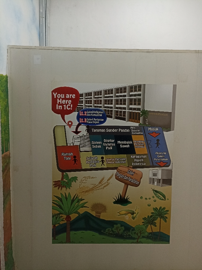
The image shows a map of the Museum Pertanian (Agriculture Museum) located in Bogor, Indonesia, at coordinates -6.603 latitude and 106.798 longitude. The map details the layout of the museum, showing various exhibits including: "Tanaman Sumber Pangan" (Food Source Plants), "Sistem Subak" (Irrigation System), "Display Varietas Padi" (Rice Varieties Display), "Membaik Sawah" (Improving Rice Fields), "Peradaban Pertanian Indonesia" (Indonesian Agricultural Civilization), "Sejarah Budidaya Padi" (History of Rice Cultivation), "Sejarah Pertanian Pangan Indonesia" (History of Indonesian Food Agriculture), "Keramaian Hayati Indonesia" (Biodiversity of Indonesia), "Rumah Tani" (Farmer's House), "Galeri Pangan dan Peradaban" (Food and Civilization Gallery), and "Akses ke Galeri Peternakan" (Access to the Animal Husbandry Gallery). The museum has two floors: the second floor has the "Galeri Kebijakan dan Komoditas" (Policy and Commodities Gallery) and the third floor houses the "Galeri Pertanian Masa Depan" (Future of Agriculture Gallery). The map also shows the entrance, labeled "Masuk," and a lift. There is a white wall in the background.
Loading AttnAds…
No transactions found