Sign in
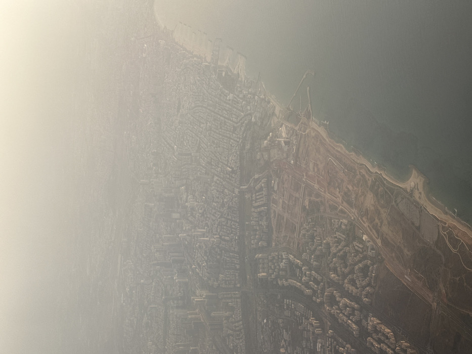
This aerial image depicts the coastline of Herzliya, Israel, extending southward, under conditions of significant atmospheric haze that reduces visibility.

The Mediterranean Sea occupies the lower right quadrant of the image, appearing calm with a muted blue-green coloration and faint wave patterns along the shore. The coastline features sandy beaches interspersed with rocky sections and artificial structures such as jetties and breakwaters.

Prominently visible in the mid-right is the Herzliya Marina, characterized by its distinctive L-shaped breakwater enclosing a basin with numerous boat berths.

Inland from the marina and extending along the coast is a substantial strip of undeveloped land, predominantly light brown earth, marked by visible dirt roads, clearings, and areas of sparse vegetation, consistent with the Herzliya Pituach area. This section suggests ongoing land preparation or a planned development zone.

Further inland, particularly in the lower-left to mid-left, is a developed urban landscape consisting of residential buildings, typically multi-story, arranged along a discernible street grid. A major transportation artery, possibly a highway, runs roughly north-south through the mid-section, separating different urbanized zones.

The upper and background portions of the image reveal an extensive, dense urban environment dominated by numerous high-rise buildings and skyscrapers, indicative of the northern Tel Aviv skyline. These structures progressively fade into the pervasive atmospheric haze, obscuring finer details.

No individuals or explicit actions are discernible within the scene. The perspective is static, captured from an elevated vantage point.
Matteo

Nov 5, 2025, 2:02 PM

Herzliya, Israel

Stake attention in this memory

overwhelming
uncertainty
density
distant
isolation

This aerial image depicts the coastline of Herzliya, Israel, extending southward, under conditions of significant atmospheric haze that reduces visibility. The Mediterranean Sea occupies the lower right quadrant of the image, appearing calm with a muted blue-green coloration and faint wave patterns along the shore. The coastline features sandy beaches interspersed with rocky sections and artificial structures such as jetties and breakwaters. Prominently visible in the mid-right is the Herzliya Marina, characterized by its distinctive L-shaped breakwater enclosing a basin with numerous boat berths. Inland from the marina and extending along the coast is a substantial strip of undeveloped land, predominantly light brown earth, marked by visible dirt roads, clearings, and areas of sparse vegetation, consistent with the Herzliya Pituach area. This section suggests ongoing land preparation or a planned development zone. Further inland, particularly in the lower-left to mid-left, is a developed urban landscape consisting of residential buildings, typically multi-story, arranged along a discernible street grid. A major transportation artery, possibly a highway, runs roughly north-south through the mid-section, separating different urbanized zones. The upper and background portions of the image reveal an extensive, dense urban environment dominated by numerous high-rise buildings and skyscrapers, indicative of the northern Tel Aviv skyline. These structures progressively fade into the pervasive atmospheric haze, obscuring finer details. No individuals or explicit actions are discernible within the scene. The perspective is static, captured from an elevated vantage point.

Loading AttnAds…

transactions
revenues
stakers
Earliest
Latest
Highest stake

No transactions found

More from this user

More from Herzliya

Matteo

Nov 5, 2025, 2:02 PM

Herzliya, Israel

Licensed under Creative Commons Attribution 4.0 International License. You are free to share and adapt this content with proper attribution.