
Sign in
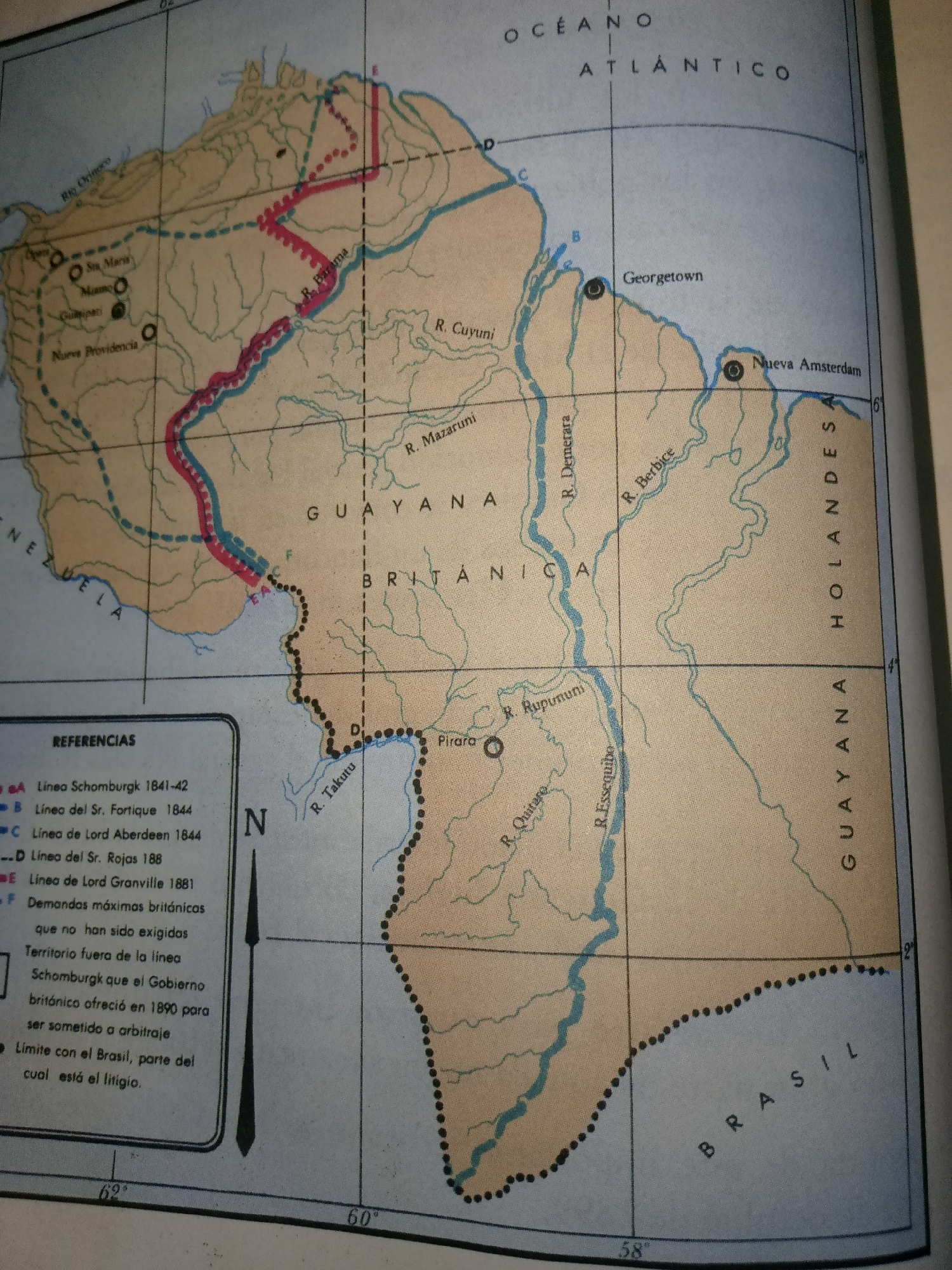
The image is a map of the Guayana region, likely a historical map given the references to various boundary lines and dates. It shows rivers, national borders, and cities like Georgetown and Nueva Amsterdam. The text is in Spanish, with labels such as "OCÉANO ATLÁNTICO," "GUAYANA BRITÁNICA," and "BRASIL." There is a "REFERENCIAS" section that lists different boundary lines and claims. The city of Guayacán, Venezuela, is not explicitly shown or labeled on this map; however, the map does depict the general region that includes parts of Venezuela. The map is rendered in muted colors, with shades of tan, blue, and red used to demarcate territories and features. There are no people or explicit actions depicted in the image.
FM-COnal1

Jul 1, 2026, 1:30 AM

Guayacán, Venezuela

Stake attention in this memory

historical
cartography
geopolitical
educational
exploratory

The image is a map of the Guayana region, likely a historical map given the references to various boundary lines and dates. It shows rivers, national borders, and cities like Georgetown and Nueva Amsterdam. The text is in Spanish, with labels such as "OCÉANO ATLÁNTICO," "GUAYANA BRITÁNICA," and "BRASIL." There is a "REFERENCIAS" section that lists different boundary lines and claims. The city of Guayacán, Venezuela, is not explicitly shown or labeled on this map; however, the map does depict the general region that includes parts of Venezuela. The map is rendered in muted colors, with shades of tan, blue, and red used to demarcate territories and features. There are no people or explicit actions depicted in the image.

Loading AttnAds…

transactions
revenues
stakers
Earliest
Latest
Highest stake

No transactions found

More from this user

More from Guayacán

FM-COnal1

Jul 1, 2026, 1:30 AM

Guayacán, Venezuela

Licensed under Creative Commons Attribution 4.0 International License. You are free to share and adapt this content with proper attribution.