Stake attention in this memory
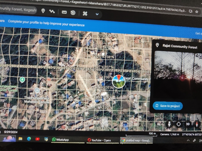
The image is a photograph of a computer screen displaying a Google Earth interface. The central focus is a satellite map view centered approximately on 27°43'06"N, 85°23'54"E, depicting an area within the Kageshwori Manohara region of Kathmandu Metropolitan City, Nepal. The map illustrates a mix of residential structures with visible rooftops and forested areas, traversed by roads, with a grid overlay displaying latitude and longitude coordinates. A red pin icon marks "Rajat Community Forest," accompanied by a circular thumbnail image of trees. A green pin identifies "Thadhungeshwor Mahadev Temple" to the southwest. A 100-meter scale bar is visible, alongside a camera altitude reading of 1,968 meters. To the right, an open side panel titled "Rajat Community Forest" displays a larger image featuring tree silhouettes against a bright, possibly sunset or sunrise-lit sky. A "Save to project" button is present within this panel. The browser's URL bar contains coordinates and the name "Kageshwori Manohara." The taskbar at the bottom of the screen shows the date "5/29/2024" and icons for applications such as WhatsApp, YouTube, and Opera. No individuals or direct human actions are depicted.
No transactions found